


OUT AND ABOUT WITH RALPH: The 'new' roads through the Caithness flows
Register for free to read more of the latest local news. It's easy and will only take a moment.

I still think of them as new roads, but they have been there for over 30 years. When I first lived here, it was a slow, rough and largely pathless expedition to cross the Caithness flows from north to south or east to west, except of course by train!
Then came the tax-avoidance forestry and many new tracks were built, the main one linking Forsinain with Loch More. The forests failed commercially and environmentally and are now being removed, but the tracks remain.
There used to be a well-built but completely overgrown path from Glutt Lodge to Braemore, this was dug out and converted to a hard paved track at about the same time. Now these through tracks provide the easiest way of crossing the flows and will likely become much more popular if the area achieves world heritage status.
Pedalling my new e-bike over to Braemore I realised it was 45 years almost to the day since I first drove into the glen for a walk across Scaraben and Morven. Which really made me feel old.
Many times since, when training for events, I’ve jogged the six-mile track to the (now locked) Gobernuisgeach bothy, returning via the summit of Morven. Such fitness eludes me now, but it was good still to be able to repeat a moorland crossing I hadn’t done for many years.
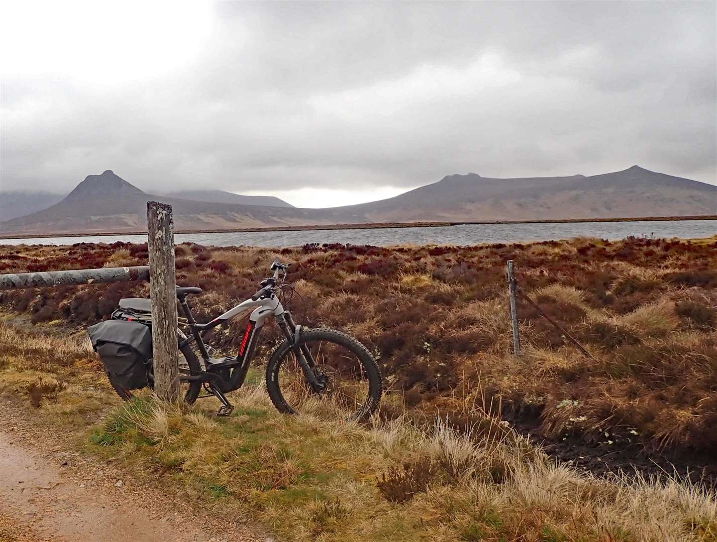
The stony track to Glutt is well-surfaced, indeed not that much worse than some of our public roads. But if your saddle is uncomfortable you’ll certainly feel it.
It was a grey, cold first of May, more like the first of March, with drizzly showers and shivering lambs. The route climbs steeply above the Berriedale water (whose salmon featured largely on Attenborough’s recent BBC TV series Wild-Isles) then turns northerly past the lochan of the streaky cows – you see the track disappearing far into the distance over the moors. A true yellow-brick road.
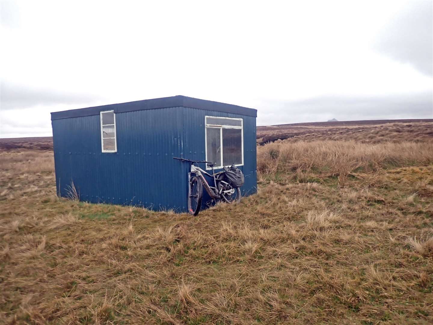
Two miles on, the track dips across the headwaters of the Dunbeath river and there’s a handy hut for lunch shelter out of the cold wind (or summer midges). A Gideon’s Bible, once belonging to Leah Wilson, has been there for many years.
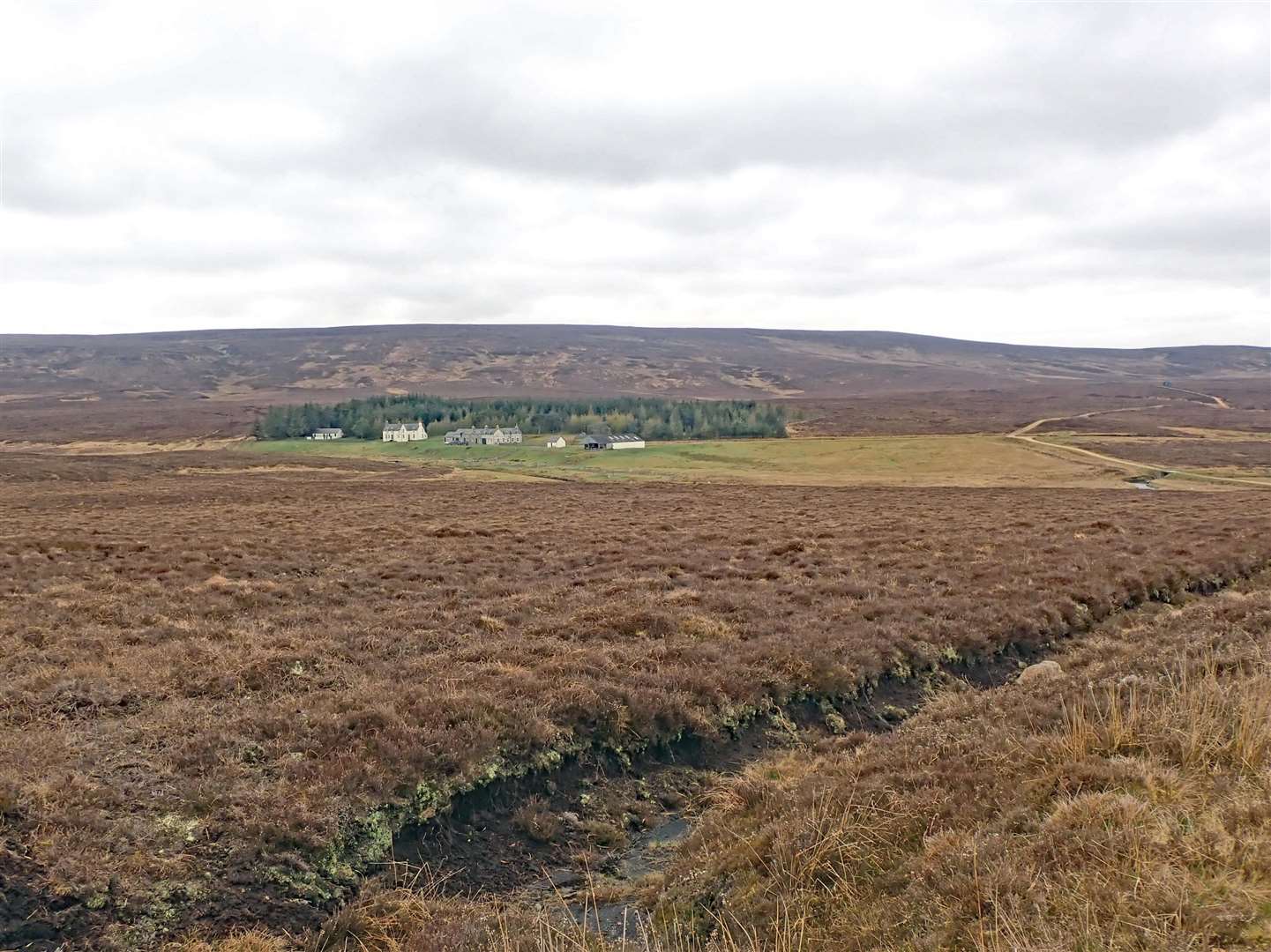
After another climb, Glutt Lodge appears in the distance at the foot of a long descent. Most local people will never have seen this out-of-the-way dwelling unless they are connected with the estates, but it’s not really that remote with two good access tracks and is closer than Thurso to Inverness.
It’s a long, bumpy 10 miles to Loch More. Dalnagachan and Dalnawhillan Lodge are now derelict, although there is still a keeper and kennels with ever-barking hounds. A few golden plover piped and there was a grand view of a male hen-harrier flying low, white wings with black tips.
At Loch More, a half-hearted cuckoo called a couple of times, probably feeling the cold. The track from Forsinain via Altnabreac joins here, under the baleful eye of a CCTV camera pointed straight at the the gate and a nice picnic bench. So don’t get up to too much here with your partner.
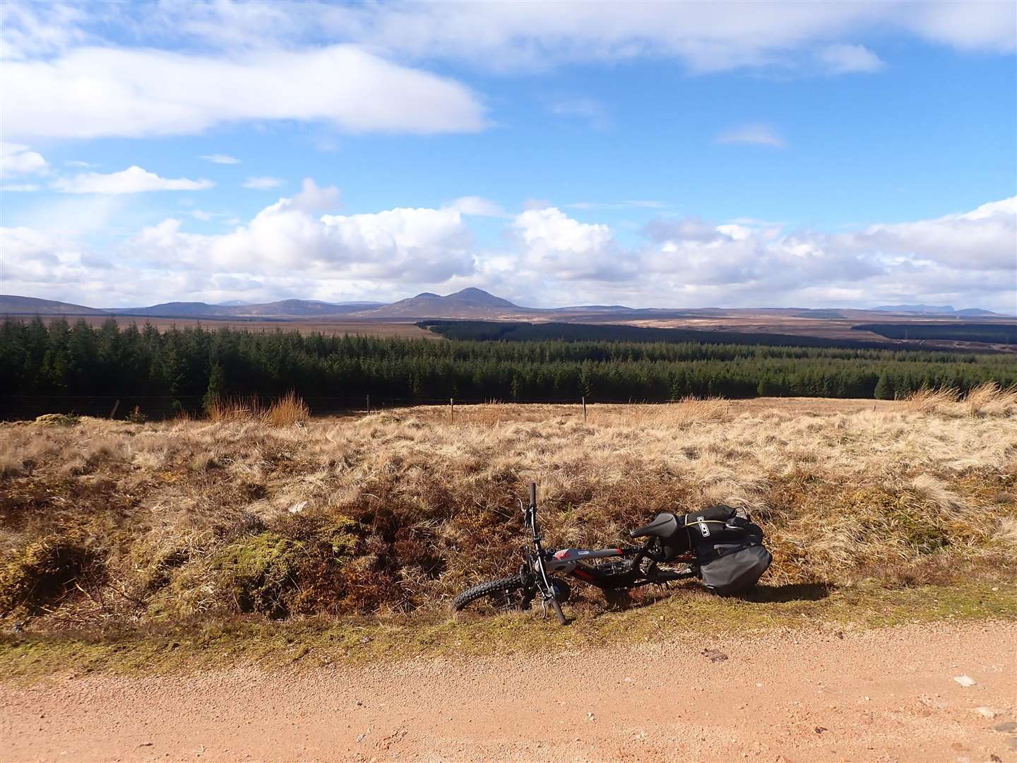
A couple of weeks earlier on a better day I’d come that way, cycling round via Strath Halladale and the long climb over Slettill Hill. The high track twists and turns for miles before dropping down to civilisation at Altnabreac – now with the trees removed there are fine views of the huge Caithness flow country.
This is a core path but Network Rail have been trying to close the level crossing near the station – at present, though, there is no obstacle to using it.
From Altnabreac you can go south past Loch Dubh Lodge to Dalnawhillan, but the shortest and easiest route is to take the ‘new’ (more than 30 years old…) forest track past Loch Caise – where a circular walk was grant-funded then abandoned a few years later.
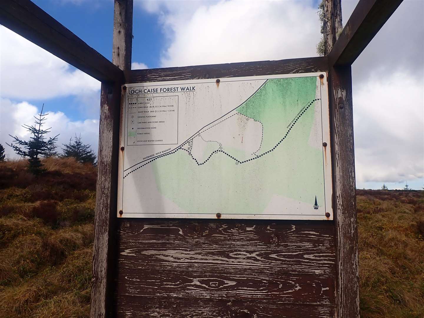
The information board still stands, a memorial to public money sunk in the bog. A lot of the very slow-growing trees have been felled and the track now has much more open views, it used to be about the most boring in the county. You emerge at that gate and track-junction and it’s just a mile to the public road.
After all that jarring cross-country, the smooth tarmac, even if with a few potholes, is bliss and it’s an enjoyable ride back across the moor to Westerdale with the river below. The routes give a round cycle of 50-70 miles, but if you could organise transport to both ends, the through route to Loch More from either Forsinain or Braemore would make a great little trip with adventurous youngsters on a fine day!