OUT AND ABOUT WITH RALPH: Taking it slowly shows scale of landscape
Register for free to read more of the latest local news. It's easy and will only take a moment.

Exploring a new stretch of coastline around the Seaboard villages of Easter Ross, visiting the Tarbet Ness lighthouse on an overnight kayak expedition
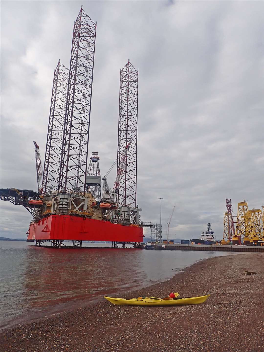
Balintore, Nigg, Arabella, Portmahomack… how often have we speeded past the signposts to these places? Now for once I turned off through the neat village of Arabella to the former fabrication site at Nigg.
It’s now oil storage, off-shore wind construction and decommissioning. I unloaded the kayak with camping gear and left it on the stony beach under the shadow of a tall jack-up rig (the ‘Well-Safe Protector’) parked next to the terminal of the little ferry across to Cromarty.
I planned a two-day trip up past Balintore and round Tarbat Ness to Portmahomack, a stretch of coast I’d never explored. First though a drive across to the destination to leave the car then a 15-mile cycle back to Nigg, endless prairie fields of golden barley, some wheat and potatoes, almost no livestock and the wealthiest farms in Scotland.
At last with the bike safely locked to a fence I could paddle off in what was now early afternoon towards the North Sutor headland. The weather was set fair, the waves gentle.
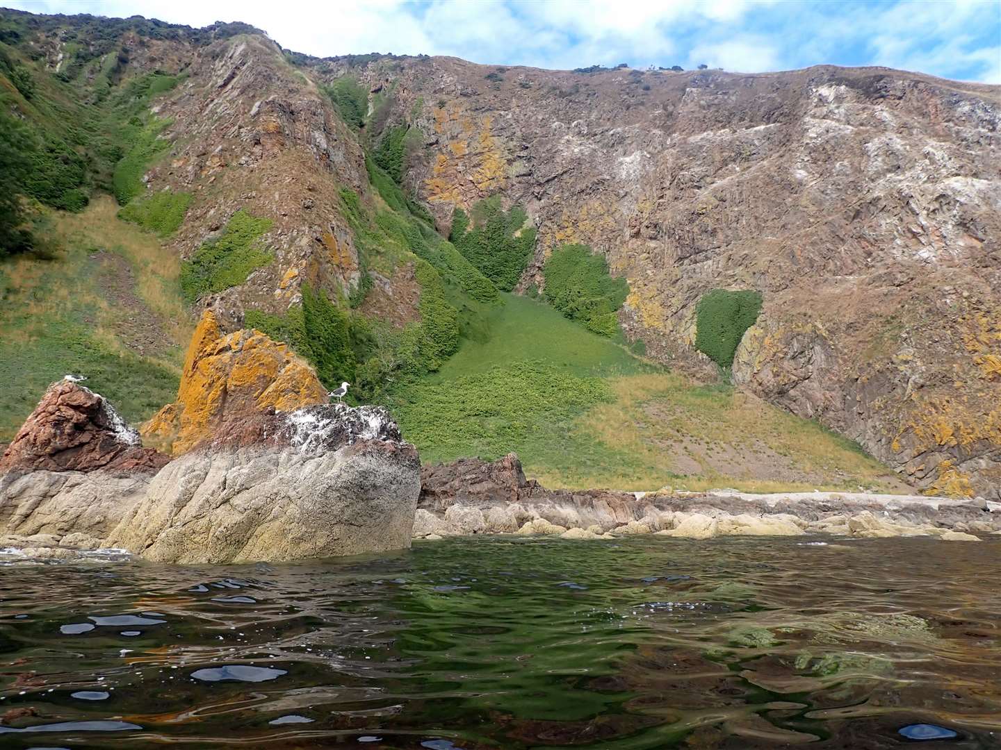
Instantly I was away from the industrial site, with golden beaches then bouldery shores rising to broken cliffs and wartime relics perched on the North Sutor stacks. Turning northwards the cliffs rose higher, occasionally broken by enticing stony beaches. A few late kittiwakes with well-grown peeping chicks still sat on guano-coated ledges.
The trouble with a longer paddle is that you need to keep going and can’t stop to explore every beach and bay, however attractive they look! It was turning warm, I was over-dressed and did manage a break at one lovely cove of pebbles and trickling waterfall for a cool-off and late lunch.
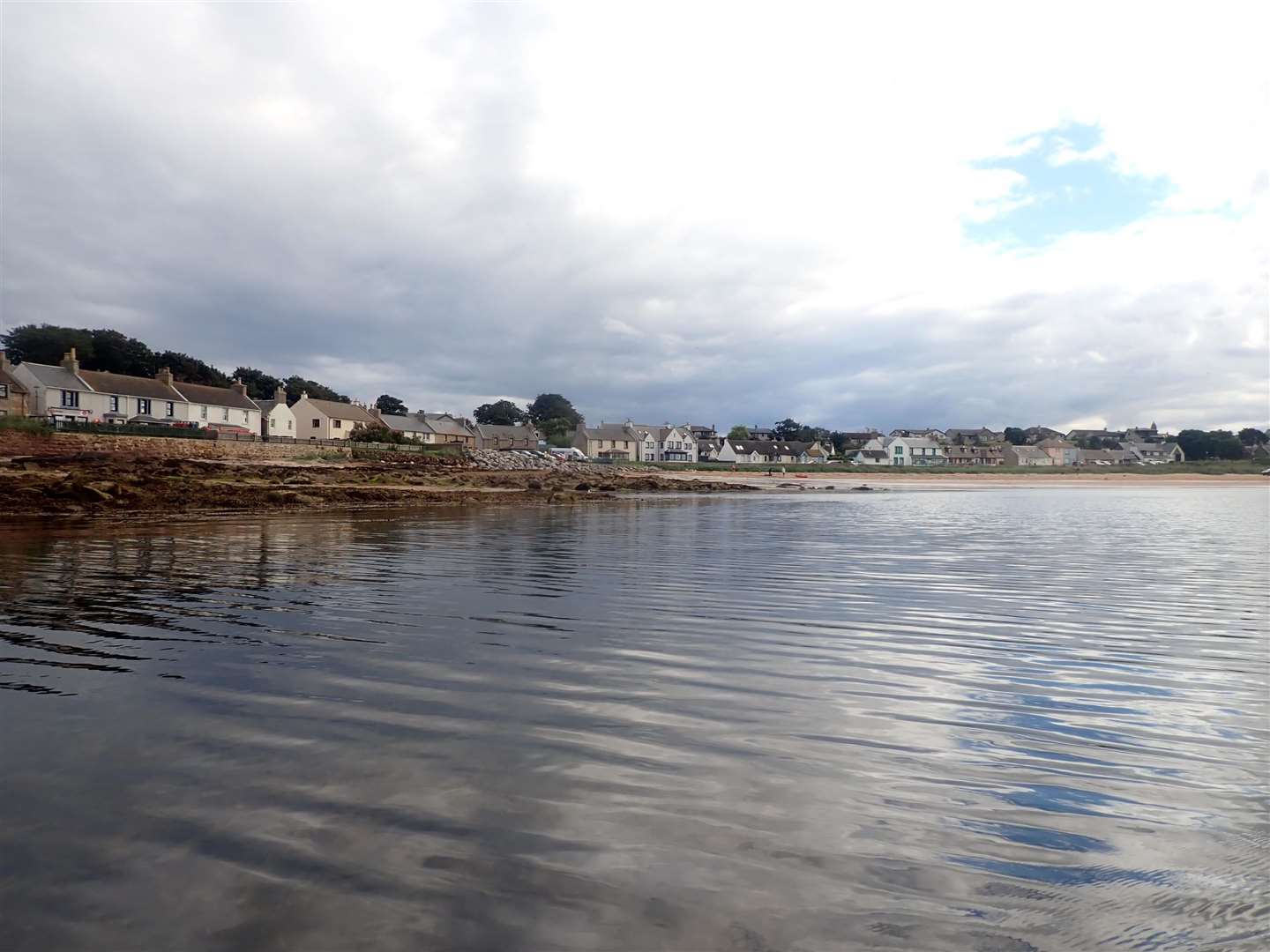
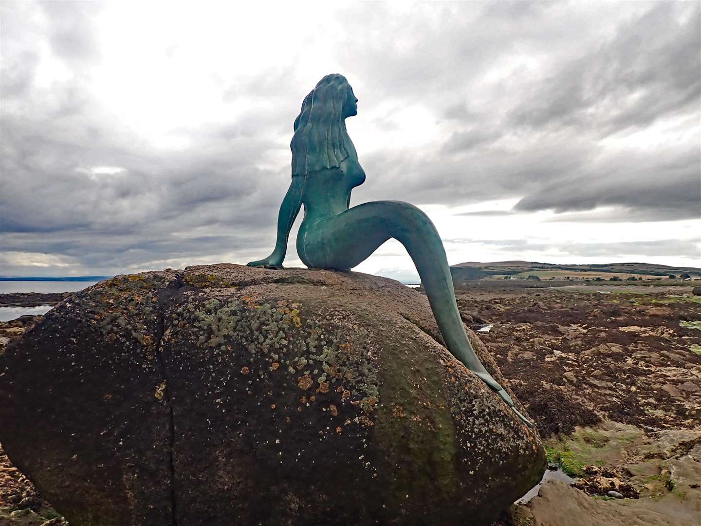
It’s a surprisingly remote bit of coast of fine cliffs and occasional small caves, the miles passed quickly to the first possible get-out at Balintore. I looked into the harbour then stopped a little further on to say hello to the Balintore mermaid perched on a big rock just below the high-tide mark.
It’s another 10 miles up to Tarbat Ness lighthouse, low cliffs above a raised beach guarded from the sea by broken rocks which make landing difficult. A very quiet and remote-feeling coast, even though beyond the cliffs is fertile farmland.
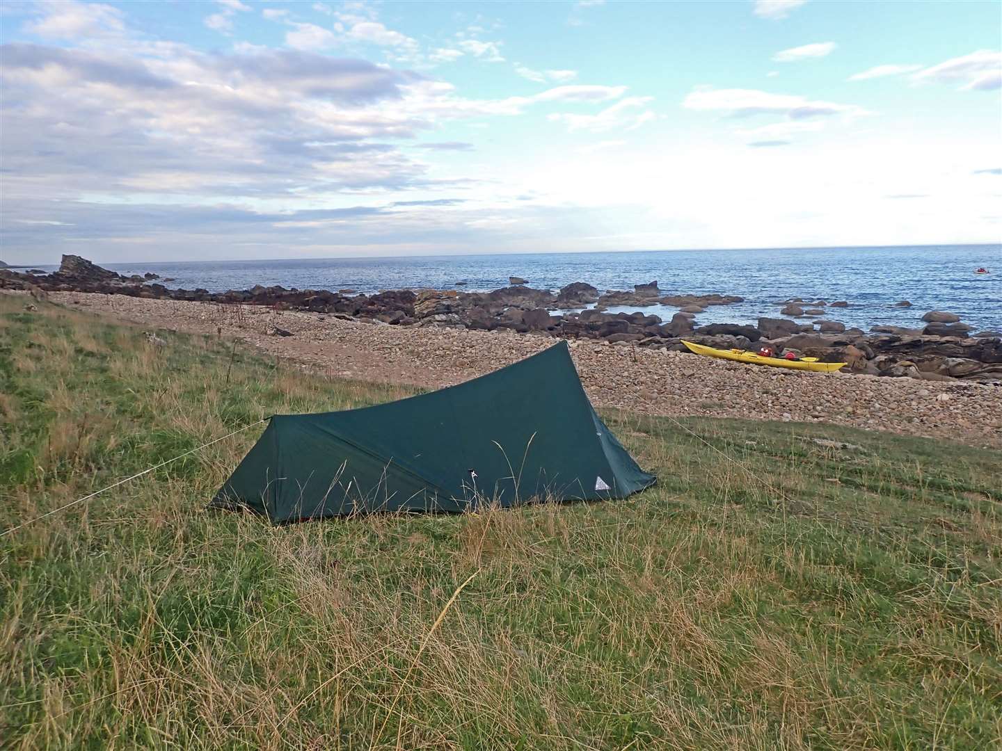
Three miles on, now evening, and time to stop. Scraping yet more plastic off the bottom of the boat, I hauled it over and between the rocks to above the tide-line, then unpacked and set the tent up on level grass under the cliffs. An ideal spot, a fine evening and not even any midges – it had been too dry.
Fortunately I’d remembered to bring water with me, these trips need a fair bit of planning. I looked out over the firth to the hills behind that long coast east of Nairn. Far off, two cruise-liners were on their way out from Invergordon and a tug hauled a wind-turbine base slowly eastwards on a barge.
Warm sun woke me the next morning, rare indeed for a Highland camp! It took a while to get going but I was eventually paddling on, mile after mile of deserted cliff and shore only broken by the small village of Rockfield.
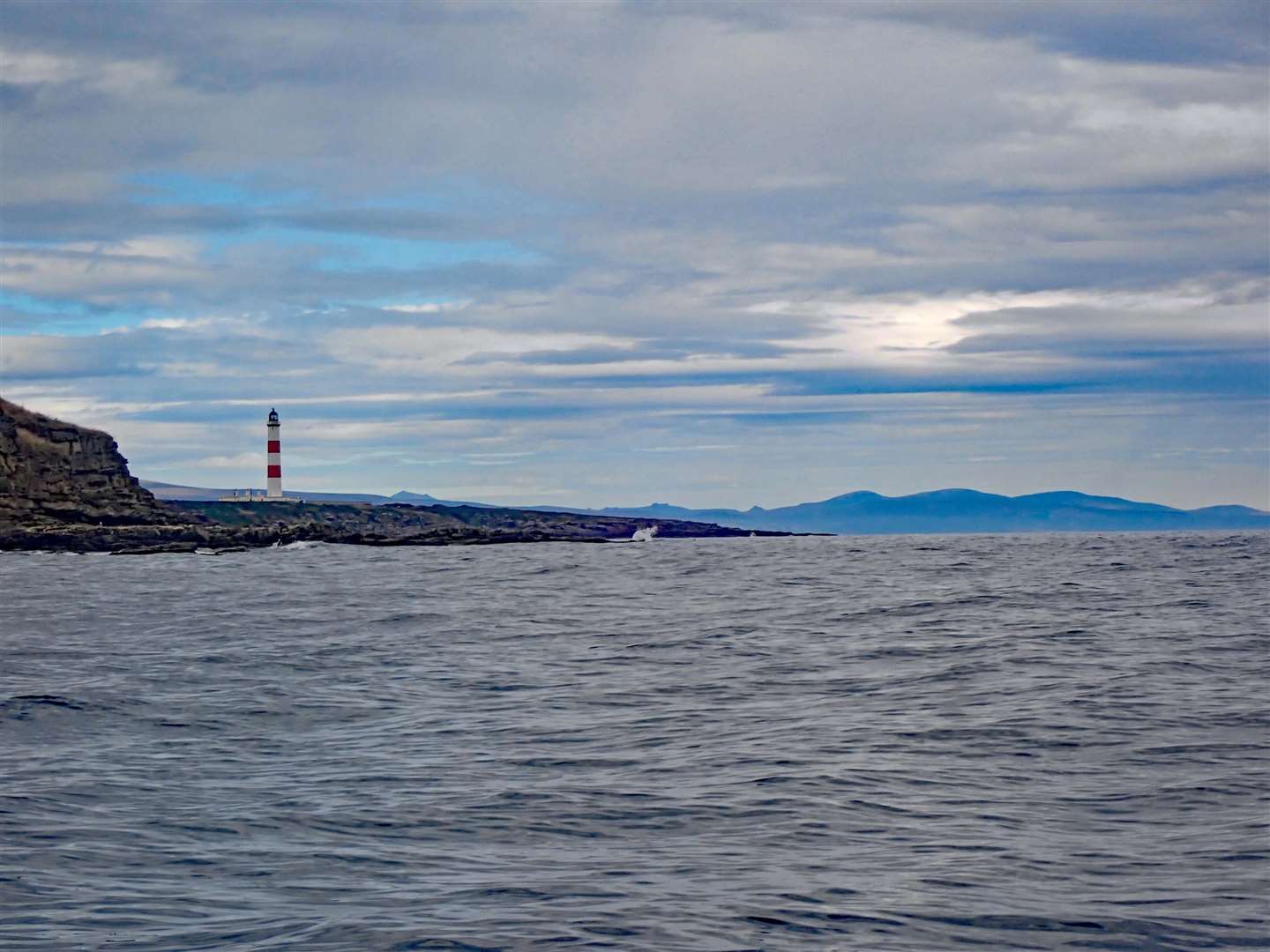
I prepared for rougher seas at the point of Tarbat Ness but there was little more than a rolling swell as I passed the tall red-and-white lighthouse and rounded the headland to head back westward.
Now the views opened out across the wide Dornoch Firth to the hills of Caithness and Sutherland, a long skyline from Scaraben and the Ord through Golspie, with the white dot of Dunrobin Castle and Ben Vrackie behind, to the Mound under Princess Cairn.
Westward the Dornoch Firth stretched far into the distance backed by the hills beyond Alladale towards Ullapool. It’s a huge scale of landscape you don’t appreciate until you take it slowly.
The remaining few miles were easy, increasingly gentle shorelines to the town of Portmahomack which sits above a wide sandy beach giving a good landing. The afternoon sun was hot and paddle-boarders were enjoying the splashing waves.
Just a question now of unpacking, carrying stuff up to the car then dragging the boat up to fasten it back on the car roof. Then a drive back to Nigg to collect the bike.
After all that, a meal of scampi and chips from The Trawler at Golspie was well-earned!