OUT AND ABOUT WITH RALPH: Enjoy the beauty of Caithness landscapes... while you can
Register for free to read more of the latest local news. It's easy and will only take a moment.

No-one can deny that the view out to sea on a clear day from Sarclet has been wrecked by the Beatrice wind farm, due to be greatly expanded.
Whether that is a price worth paying is an open question, but I remain sceptical of the motives of those who would save the planet by destroying that which makes it worth saving.
The Caithness coast remains as wonderful as ever but developers consider it just another exploitable resource. I, for one, never knew until a week ago that serious consideration has been given to taking a huge HVDC cable offshore through the cliffs south of Wick, or through the pristine sands of Freswick Bay. Both options still remain open…
So it is even more important to appreciate our landscapes before they are completely industrialised by 200-metre wind turbines and webs of power lines. Putting aside such sombre thoughts, I set out to just enjoy a favourite kayak trip from Sarclet up to Wick.
You want a good day for such a journey, aside from the very exposed nature of this coast there is no opportunity to explore if big waves are rolling in.
You can paddle one way and walk back along the clifftops or do as I did and cycle from Wick, where I’d left the car, to Sarclet, where I’d left the boat. A sturdy kayak trolley helps with the long steep descent to the rocky shore.
Around the red clover and yellow vetch, butterflies fluttered – bright common blues, meadow browns, spotted fritilleries and others, it’s worth a visit on a sunny day just to see them.
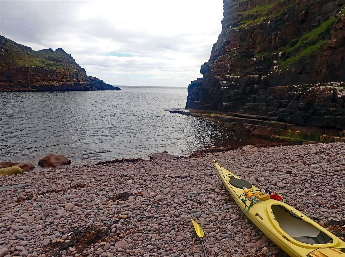
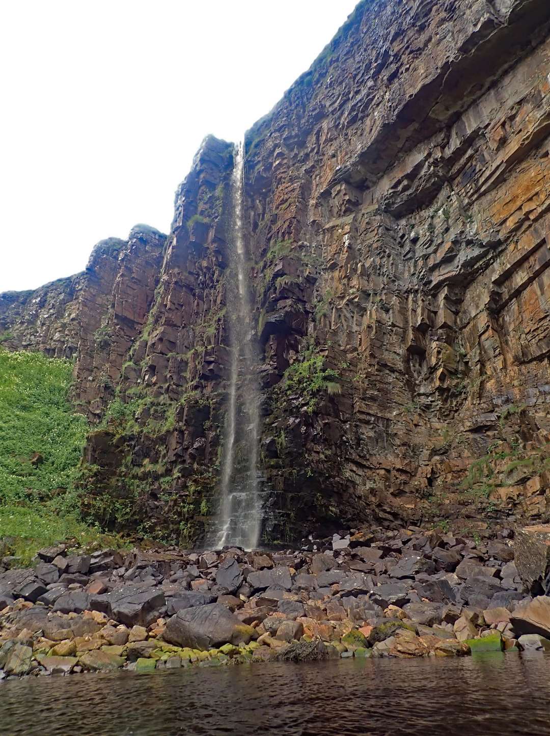
At last I slid the kayak into the sea and set off round the first headland. It was pretty calm with a light west wind gusting to at most force four, ideal for pottering around the geos and caves which make this coast so spectacular, long Broad geo with it’s high waterfall, narrow Tod’s geo, and the even longer Ashy Geo with a bouldery beach at the far end.
That was a good place to land for a snack as a heavy shower came on, with shelter under a big overhang.
Many kittiwakes had already fledged – summer can be over before you’ve hardly noticed it – but quite a few young birds still sat on their ledges. There was only the occasional dead gannet washed up, the bird flu seems to have hit less hard this year.
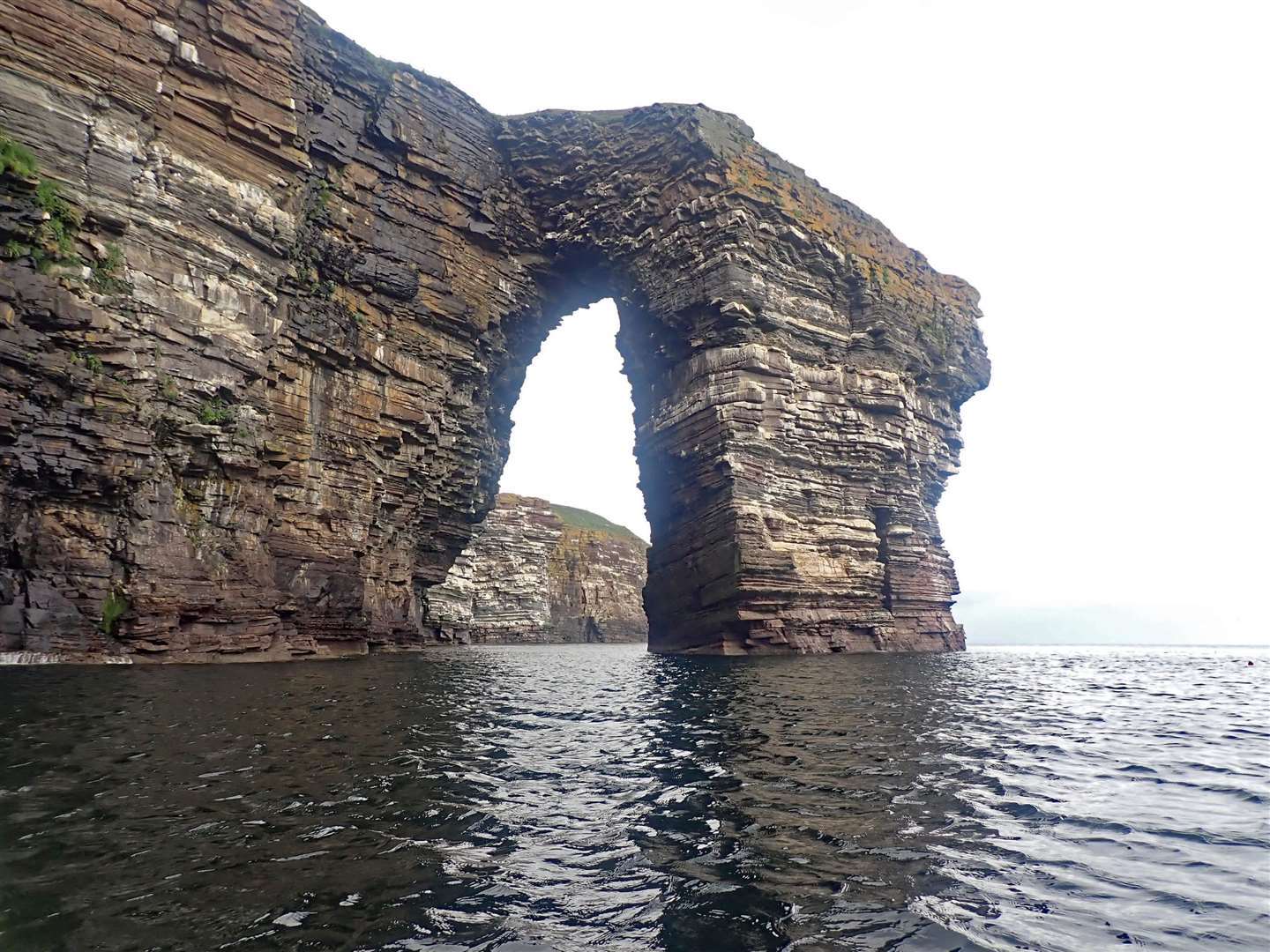
Paddling out between the high cliffs leads to the big natural arch of The Needle, exhilarating to pass under it. But never get complacent, there was the Wick lifeboat, heading south at speed on a rescue mission, an hour later it came back towing a small boat. A sudden offshore squall with choppy waves as I crossed the mouth of Ires Geo made sure I kept alert!
The coast of caves and cliffs carries on, I can never remember the details, just a general blur of paddling into dark caves and out through hidden exits, under cliffs of kittiwakes, of shags lined up on rocks of surging swell.
Helman Head is a key point, once round this exposed promontory you’re more than halfway.
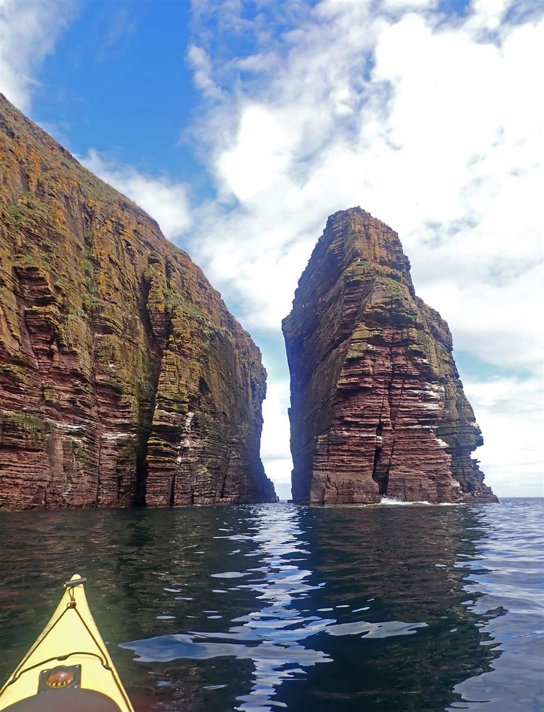
The tide was high, allowing me to paddle right round the big Girston stack then on through a delightful deep slot between Dunbar Stack and the main cliff. Two long geos at Gote o’ Tram are both worth paddling down, they look deep, dark and forbidding from the cliffs above.
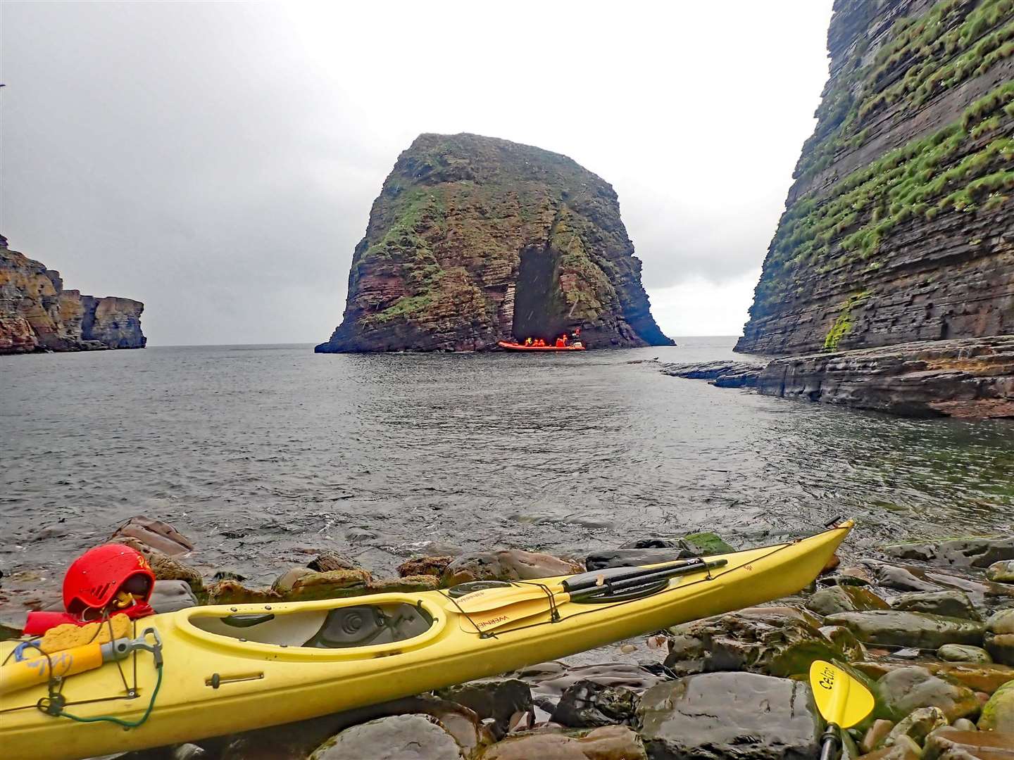
An unexpected natural cave links the two, then you paddle round the next headland and across to one of the highlights of this trip, the huge stack of the Brough, better known as Scorries Island.
A tunnel, nearly a quarter of a mile long, leads from end to end with a big opening above halfway – if conditions are good it is a unique experience to paddle right through. You must, though, land on the stony beach opposite the stack, newly beach-cleaned of a lot of rubbish!
The narrow passage under the Brig O Tram is another highlight, you’ll of course have walked over it many times, looking down into the forbidding depths below. The caves, geos and bays around the Castle of Old Wick all worth spending time exploring.
Let the tide take you round South Head, stop perhaps for a dip at the Trinkie, paddle under the lighthouse (look right, left and right again before crossing the harbour entrance) then across to the finish at the old slip below the Camps.
It’s warm freshwater here from the river – so try a roll to wash off the salt before getting out! Just don’t think of the increasing threats of powerlines and turbines…