


OUT AND ABOUT WITH RALPH: Dramatic edges are part of the attraction along John O'Groats Trail
Register for free to read more of the latest local news. It's easy and will only take a moment.

I’ve never been a great fan of long distance paths, the best routes are made by simply choosing your own from the map. But if you want a designated way without having to think about it, and maybe like meeting other walkers, then long distance paths are fine.
Even I sometimes walk them, once doing the West Highland Way in a very wet January and more recently walking the Deeside Way to Ballater from Aberdeen before carrying on across to Glen Clova and Kirriemuir.
I don’t know if the new John O’Groats Trail will ever become popular but already a few people are walking it. It’s a work in progress and there are still one or two tricky sections. Let me take you through Freswick.
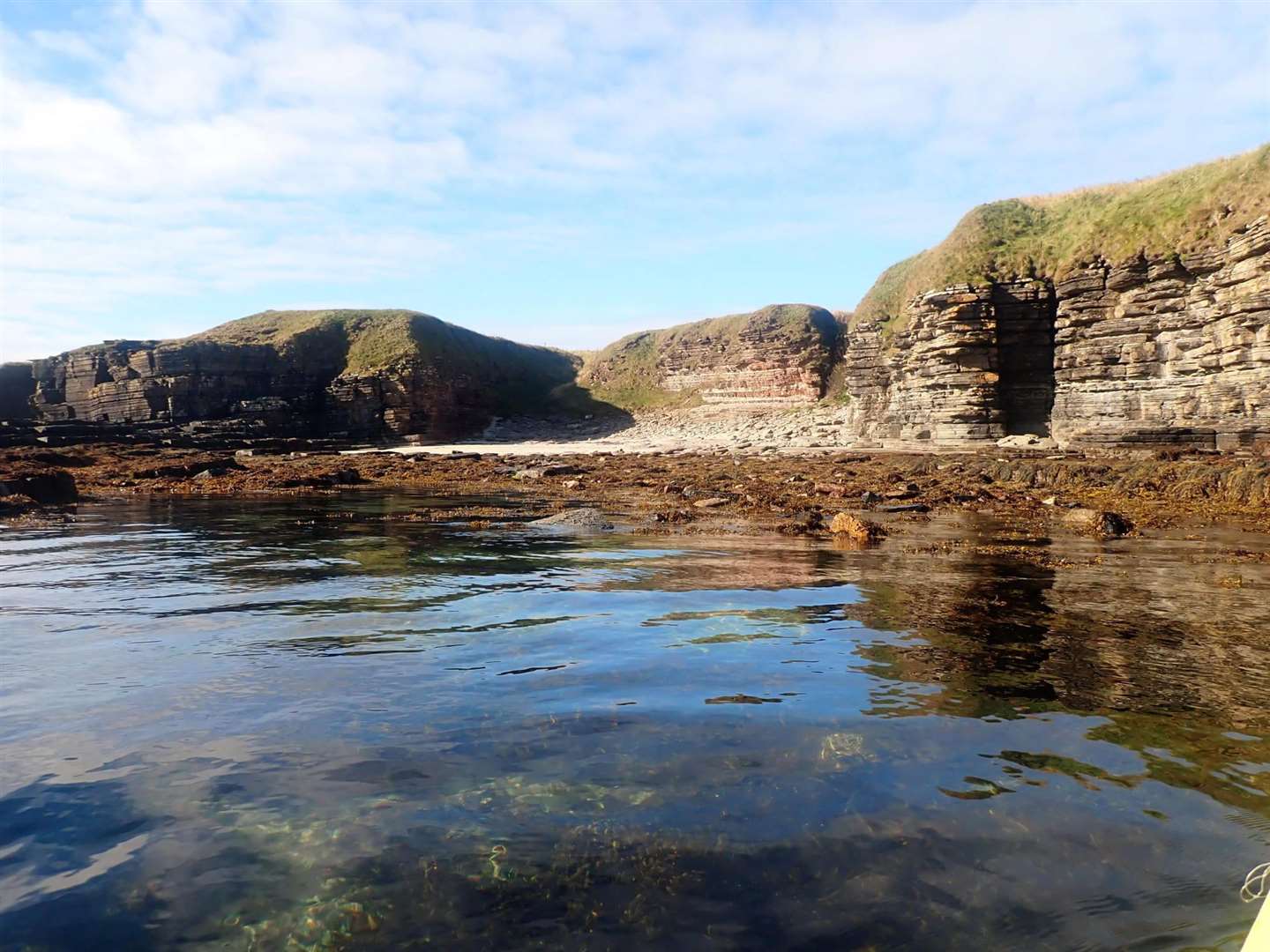
From Duncansby Head to Skirza is a straightforward and spectacular walk along the clifftops. The route then gets a little more difficult, you either wend around a headland of deep geos or brave the barking dogs of the farm to end up at the little harbour of Skirza.
It’s an attractive spot with a steep harbour slip between boulder beaches but can be a bit smelly with accumulated rotting seaweed! The original trail route now heads through wet fields of cattle above low cliffs to Freswick beach – this has now been diverted to a much easier route which simply follows the quiet road with fine views out across the bay.
There is, though, an even better route if you are fit and agile, simply keep along the bouldery shore below the cliffs, stepping from rock to rock. At high tide this route may be blocked but there is no danger of being cut off, you can simply retreat the way you came.
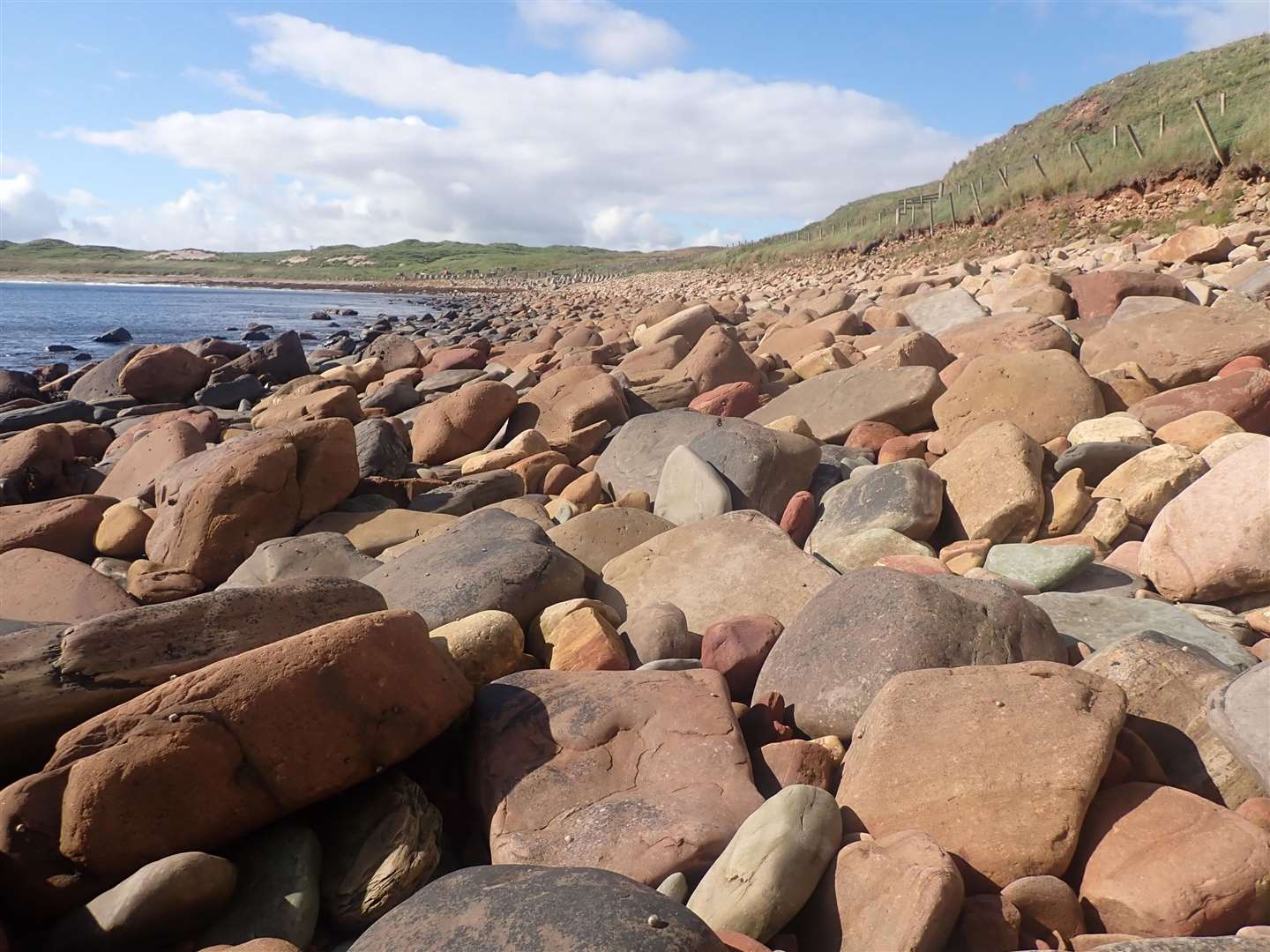
Halfway along, a huge dead tree has been washed in, its roots still grasping a rounded granite boulder perhaps from the banks of the Findhorn or Spey where the tree was dislodged in some past flood. Once the tree has rotted, the rock will pose a puzzle to geologists lying as it does among the Caithness sandstones!
Freswick is a very fine bay of white sand below ancient Viking settlements. You may get your feet wet fording the burn at the far end, and in spate you can detour to the right through a metal field gate and along a muddy track above the burn to a bridge, then descend a permitted route below Freswick Castle via a wicket gate on the left.
Then follows maybe the most awkward part of the whole trail. An overgrown trod just above the foreshore and under the wall of the castle garden leads to a bridge over an old mill-race and a short flight of steps under the old mill.
The path then heads through dense weeds along a very narrow strip between a drystane wall and a crumbling cliff, at times forcing you to the very edge. There are a couple of especially dodgy bits. Best is to avoid this altogether by keeping along the foreshore, there are some nice sandy beaches between rocky stretches but at high tide you would have to wait before you could get round a little headland.
You can then make a way up from the last little bay through tall dense weeds to regain the path beyond the dangerous stretch.
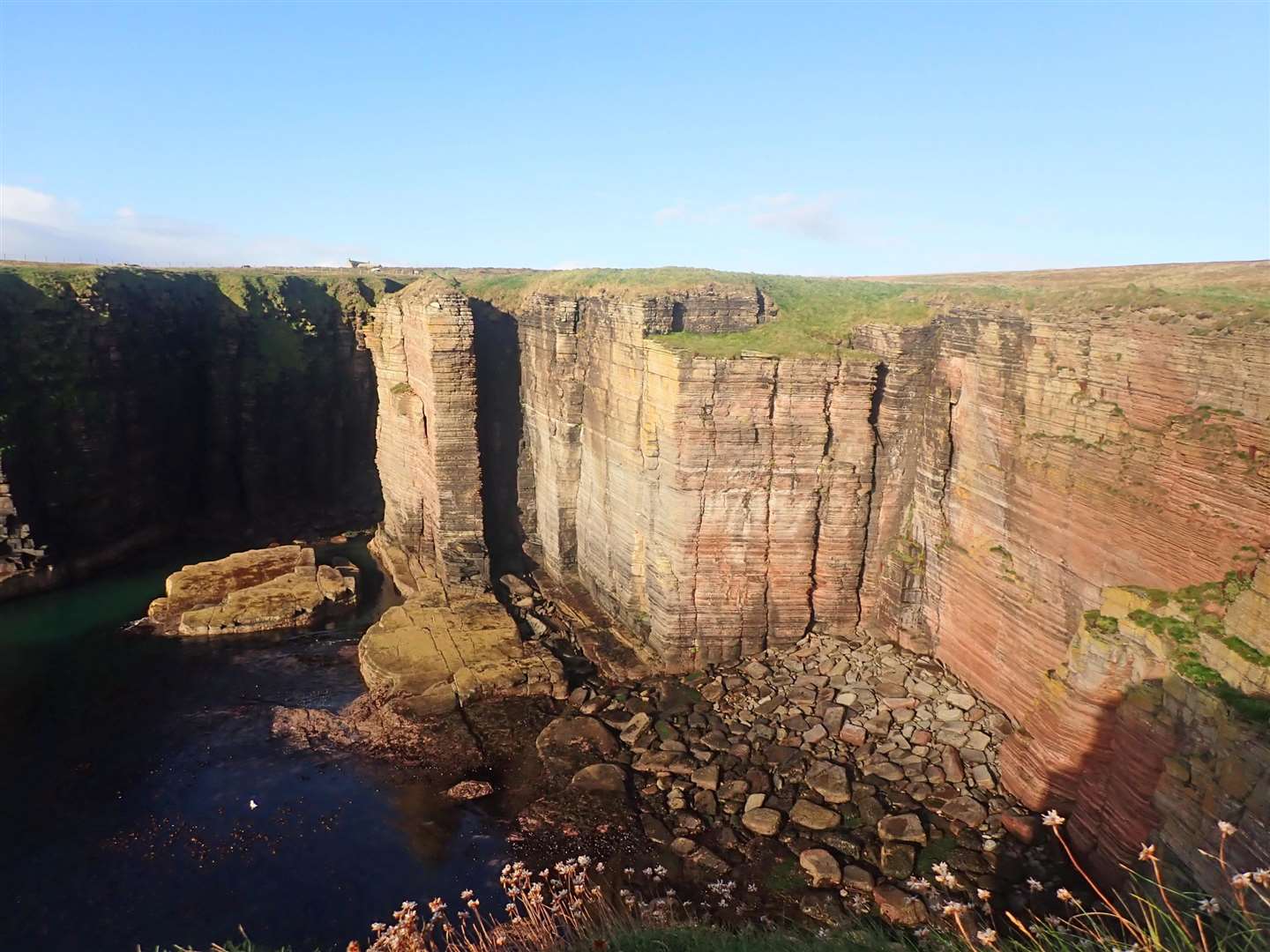
Now things improve, a little path takes you round the cliffs above skerries and boulder-bays, aiming for the ruined Bucholie Castle. There are alternative, higher paths, the higher you go, the shorter it is. The moors can be wet, and from August are bright with purple scabious.
The castle is one of our more spectacular ones, perched on an ‘almost’ sea-stack. Access through the archway is easy as long as you’ve a good head for heights and don’t pull on any rocks or stones when scrambling up or down!
Beyond, on the stack, are many ruins of old buildings amid a wild flower garden with glorious views of the sea and coast. It’s one of my favourite spots, and certainly one of the trail highlights. After that, it’s a straightforward five miles to Keiss.
It’s much easier to see this stretch from a sea-kayak on a suitable day. Freswick Bay itself is often quite sheltered but the swell picks up once you venture south or north. Bucholie Castle looks even more imposing from below and you can paddle through two caves which pass right under the headland. There’s also a little hole at Ness Head which provides a challenge to get through in breaking swells!
And that is just one short stretch, maybe three miles. To explore the whole trail properly would take weeks.