Yellow snow and ice warning across Caithness this week
Register for free to read more of the latest local news. It's easy and will only take a moment.

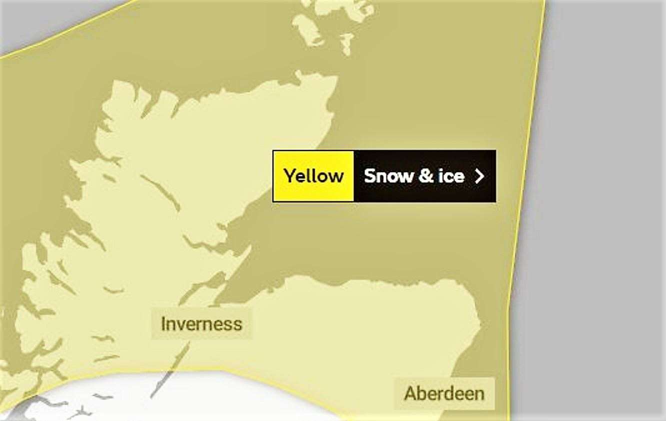
The Met Office has issued a Yellow Warning for snow and ice across Caithness that may cause travel disruption.
A bulletin posted by the Met Office at 10.04am today stated: "Wintry showers will affect many areas of northern Scotland and parts of northeast England during this period.
"A few centimetres of snow are likely to accumulate at low levels with the potential for as much as 15-20cm over higher ground. In addition, ice is likely to form on untreated surfaces, mainly where some of the showers fall as sleet close to coasts."
Posting at 8.34am today Highland Council's road condition report for Caithness states: "Much lower temperatures than forecast -4 to -6 on all routes being treated. All route treatment ongoing. Frozen snow and ice patches on all routes. No overnight issues reported."
What to expect
- Some roads and railways likely to be affected with longer journey times by road, bus and train services
- Some injuries from slips and falls on icy surfaces
- Probably some icy patches on some untreated roads, pavements and cycle paths
A further yellow warning for snow and ice will be in place from Noon tomorrow (Tuesday, December 13) to Noon on Thursday, December 15.