


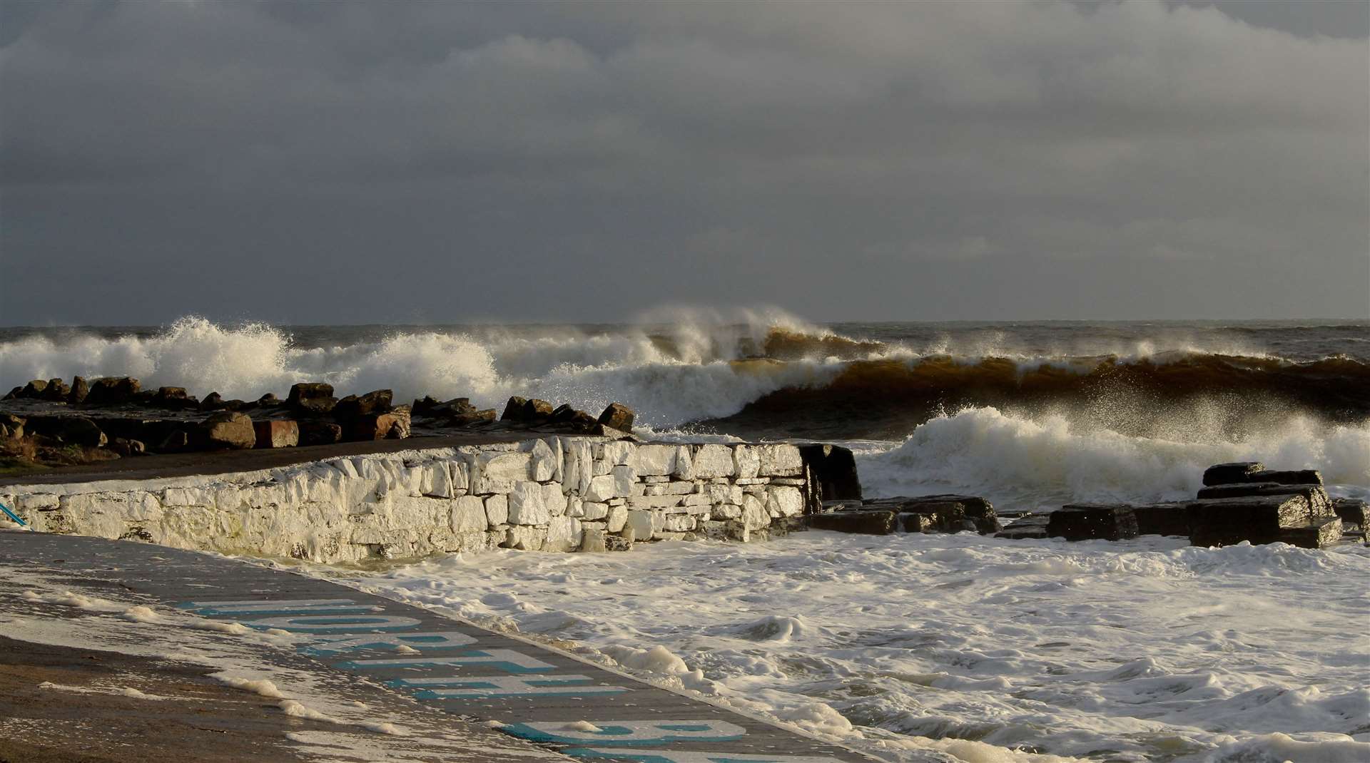
Wind and sea combine to make a powerful force
Register for free to read more of the latest local news. It's easy and will only take a moment.

Weather Watch by Keith Banks
The effects of the wind upon sea are important in meteorology. For example, weather forecasters and mariners work closely together with the purpose of providing an efficient ship routeing service.
The information gathered concerning the strength of the wind and the state of the sea can then be assessed and made available to empower those at sea to employ the safest and most favourable mercantile routes.
The World Meteorological Organization (WMO) and the International Maritime Organization (IMO), together with the International Hydrographic Organization (IHO), cooperate and make sure that ships have access to optimal and accurate real-time maritime safety information.
Sea waves have three dimensions by definition. Height is the vertical distance between crest and trough. Length is the distance between the crest of one wave and the crest of the next. Lastly, the so-called wave period is the time taken by two consecutive waves to pass a fixed point.
Fetch is the uninterrupted distance across the sea over which the wind has been blowing before arriving at the place of observation.
Swell is defined as wave motion in the sea caused by wind blowing from elsewhere. A swell can persist long after a disturbance has weakened or moved away.
A storm surge is caused by a deep and fast moving depression that is travelling across the sea. It is supplementary to the usual and expected turmoil stirred up on the sea surface by the changing wind velocities within the circulation of the low pressure area. Crucially, if the atmospheric pressure falls rapidly ahead of the depression and then rises very quickly in its wake, this can have a plunger effect on the sea and creates a large scale undulation. If the storm surge is subsequently driven and channelled into any closed confines along the exposed coastline; for example estuaries or bays, it forms inflated waves that can flood over the land. The most damaging storm surges coincide with high tides.
Finally, a negative storm surge occurs when the wind is driving the water away from the shore, causing the sea level to be lower than normal. When these events occur they can be dangerous for shipping navigating through shallow coastal waters.
July 2022 was Wick's warmest since that of 2019. Closer scrutiny of the town's historic record for mean air temperature for July showed that it is currently the ninth most warm in a series stretching back to 1910.
Wick's precipitation record for July 2022 affirmed that it was the most wet since that of 2020, and that it is presently the 46th wettest in a series commencing 1910.
Wick's mean air temperature for July 2022 was 13.99C (57.18F). The long-term average in terms of the updated 30-year averaging period from 1991-2020 is 13.14C (55.65F).
Wick's average daytime maximum air temperature for July 2022 was 17.16C (62.89F). The long-term average is 16.16C (61.09F). Highest daytime maximum air temperature was 22.0C (71.6F), observed on July 19. Maximums of 20.7C (69.3F), and 19.9C (67.8F), recorded on July 12 and 24 respectively, were also notably warm temperatures for the town. Lowest daytime maximum was 13.6C (56.5F), noted on July 22.
The average overnight minimum air temperature was 10.82C (51.48F). The long-term average for this parameter is presently 10.11C (50.20F). Highest overnight minimum air temperature was 15.4C (59.7F), witnessed on July 12. The lowest overnight minimum air temperature was 6.0C (42.8F), recorded on July 31.
The lowest temperature recorded at 5cm over the grass was 2.1C (35.8F), on July 16.
Precipitation was measurable on 28 dates. The total amount for July 2022 was 64.6mm (2.54 inches), or 104.9 per cent of the current long-term average for July. Wettest day was July 24. The total for the 24 hours commencing 9am (GMT) was 17.4mm (0.69 of an inch).
Wind velocities reached or exceeded gale force 8, (39.0mph/33.9knots) on two dates. The strongest wind velocity for the month occurred during the hour ending 2pm (GMT), on July 6, when a force 6 west-north-westerly wind gusted up to 40.3mph/35.0knots, (gale force 8 on the Beaufort scale).
Moderate electrical storms affected the town during the mid afternoon and the evening of July 19.