


Weather Watch: Striking clouds are evidence of harm to environment
Register for free to read more of the latest local news. It's easy and will only take a moment.

The stratosphere is the layer of the Earth’s atmosphere that is immediately above the tropopause, the interface between the lowest region of the atmosphere called the troposphere, where the weather forms.
Keith Banks says, in the troposphere, apart from occasions where inversions occur, the temperature decreases steadily with increasing altitude. However, in the stratosphere, the temperature increases with altitude as a consequence of heat energy released by the continuous natural cycle of the synthesis and subsequent destruction of ozone O3, caused by the absorption of the shortest wavelength UV-B and UV-C radiation that the Earth receives from the Sun. Crucially, the “ozone layer” in the stratosphere prevents almost all this harmful ultra violet (UV) radiation penetrating the troposphere. Exposure to UV radiation is extremely dangerous to human and plant life.
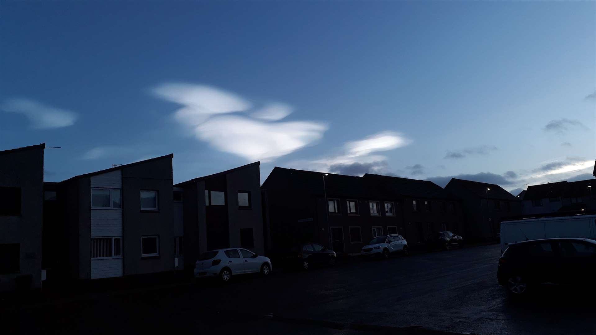
During the latter part of the 20th century emissions of chloroflurocarbons (CFCs) together with related halogen compound gases used as refrigerants (most notably bromine) and complex hydrocarbon compounds employed in industrial solvents and propellants, and used in aerosols were found to be responsible for the accelerating, systemic destruction of the ozone layer on a global scale. However the discovery and development of a vast “ozone hole” over Antarctica was the most alarming feature. Destruction above the North Pole has also occurred but less severely. The implementation of the 1987 Montreal Protocol banned the production of CFCs and other chemical substances known to destroy the ozone layer. Research has revealed the measures rolled out are allowing the ozone layer to recover, albeit incrementally. Nevertheless the stunning display of Type 2 polar stratospheric clouds (PSCs), also known as nacreous clouds, witnessed and photographed by many people in Caithness on Christmas Eve 2023, and subsequently reported in the John O’Groat Journal, are incontrovertible evidence that those chemicals essential for the chemical reactions responsible for ozone depletion are still present.
The stratosphere extends to an altitude of about 30 miles above the Earth’s surface and its upper boundary is called the stratopause.
Perusal of Wick’s historic record for mean air temperature for February 2024 showed that it was the coldest since that of 2022. However closer inspection of the archive, revealed that it was the 27th mildest in a series commencing from since 1910.
In terms of precipitation, February 2024 was also the wettest since 2022 but also the 44th driest since 1910.
Winter 2023/24 was the coldest since 2020/21. Mean air temperature was 4.39C (39.90F). Wick’s mean air temperature for winter in terms of the averaging period 1991-2020 is 4.11C (39.40F).
The Precipitation total was 246.4mm (9.7 inches). Long term winter average quantity for winter is currently 205.45mm (8.09 inches). However, rainfall amounts were unavailable for six dates in December; so this total is likely less than the actual quantity that fell on the town. Nevertheless, Provisionally, winter 2023/24 was the wettest since that of 2001-2002. The total for that winter was 295.2mm (11.62 inches).
Wick’s mean air temperature for February 2024 was 4.68C (40.42F). Long term average for February is 4.06C (39.31F). Average daily maximum air temperature for February 2024 was 7.66C (45.79F). The current long term average for this parameter is 6.72C (44.10F).
Highest maximum was 13.4C (56.1F), recorded on February 2. Lowest maximum was 1.3C (34.3F), noted on February 7.
The average daily minimum air temperature for February 2024 was 1.69C (35.04F). The long term average for February, in terms of the current 30-year averaging period, is 1.39C (34.5F). Highest daily minimum was 6.3C (43.3F), recorded on February 18 and again on February 20.
There were seven air frosts. Lowest air temperature was -6.7C (19.9F), recorded on February 8.
The temperatures fell to 0C (32F) or lower at 5cm over the grass on 13 dates. Lowest temperature noted over the grass was -8.7C (16.3F) on February 8. Precipitation was measurable on 27 dates. The total for the month was 49.8mm (1.97 inches). Wettest day was February 4. The total for the 24 hours commencing 9am (GMT) was 8.4mm (0.34 of an inch).
“Days of gale” occurred on February 1, 2, 6 and 9. The strongest wind velocity was experienced during the hour ending 4am (GMT) on February 1 when a force 8 west-north-west wind gusted up to 65.6mph/57.04knots (violent storm 11 on the Beaufort scale).
Wind velocities reached or surpassed gale force 8 (33.9knots/39mph) in the town on nine dates during February 2024.