


Weird weather – Giant hailstones and funnel clouds in Castletown, Thurso floods but it's sunny in Wick
Register for free to read more of the latest local news. It's easy and will only take a moment.

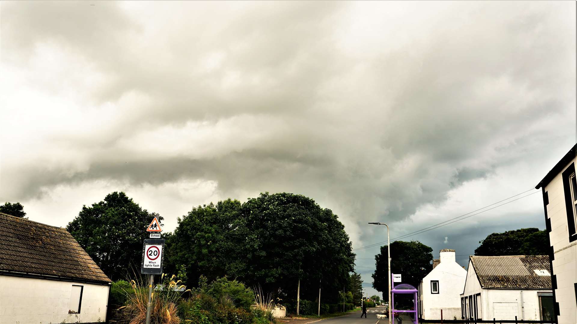
While Wickers and others in the east basked in sunshine today the western parts of Caithness experienced localised thunderstorms including large hailstones and unusual cloud systems.
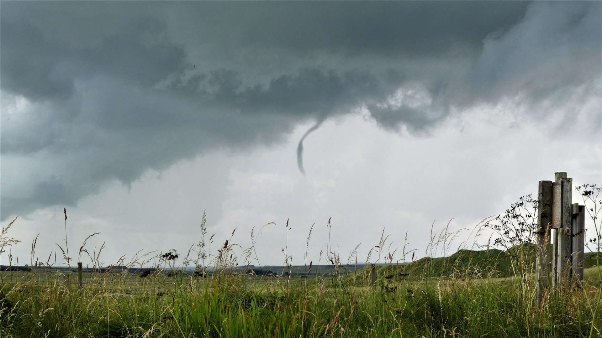
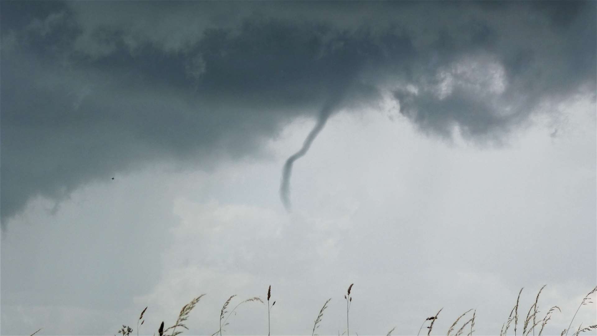
Suzie Hay saw what she thought was a "mini tornado" over Castletown but the images she captured suggest it was actually a funnel cloud. The Met Office says that funnel clouds or 'tuba' are extending, spinning fingers of cloud that reach towards the ground, but never touch it. When they do reach the ground they become a tornado.
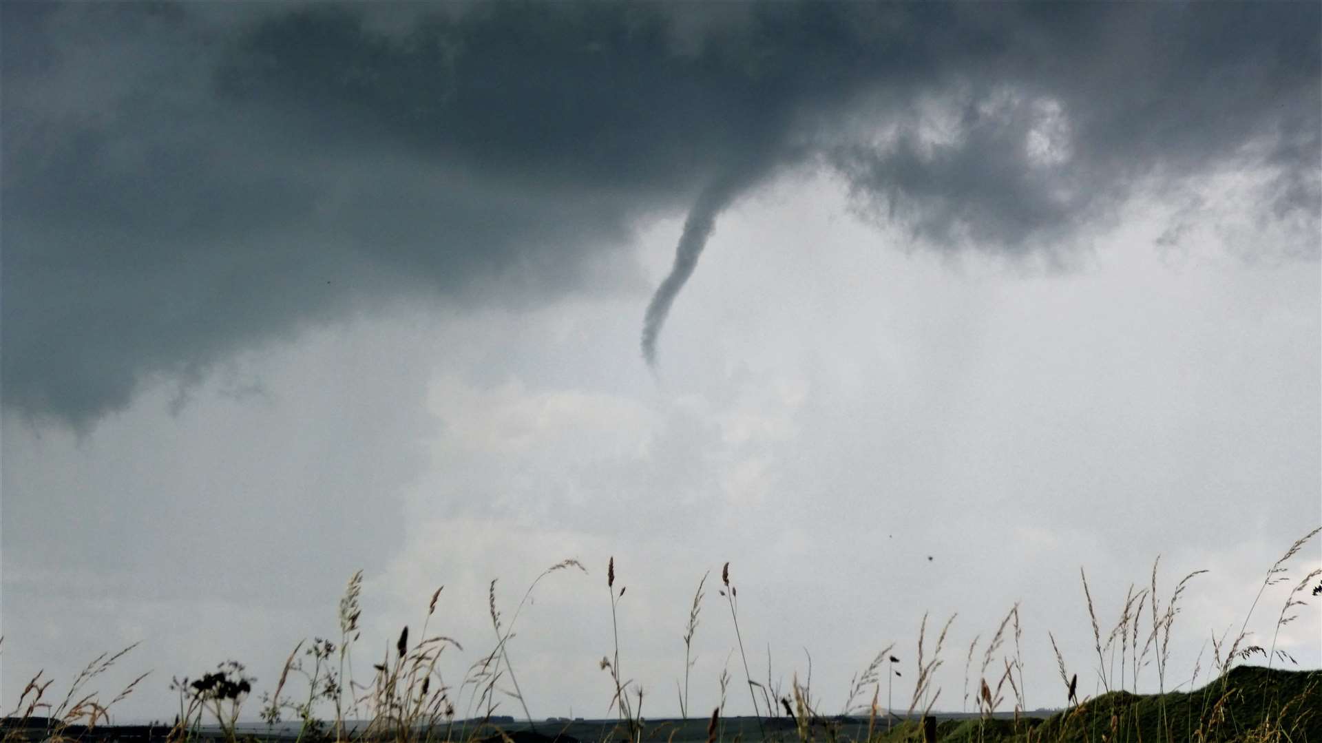
Suzie reported: "It was a slow moving thunder and lightning storm, with two big swirls and the small one that tried to turn into a funnel, in the middle of the storm clouds. It bounced down for a good 30 minutes.
"Hubby and I sat in the car watching as it came into Dunnet Bay, then the rain hit and didn't stop."
Castletown resident Neil Buchan was volunteering at Castlehill Heritage Centre along with his wife Elizabeth when a thunderstorm hit the area at around 11.30am. "The morning started off really great, warm and sunny, but by about 11am we could see the storm clouds gathering. Then at around half-eleven it really kicked off and we had to take cover."
Elizabeth was weeding paths around the centre when the thunderstorm hit and was surprised to see the size of the hailstones that were plummeting down and bouncing off the flagstones. "She went to pick some up and said they were a bit painful when they hit her. They were probably just over half-an-inch in diameter."
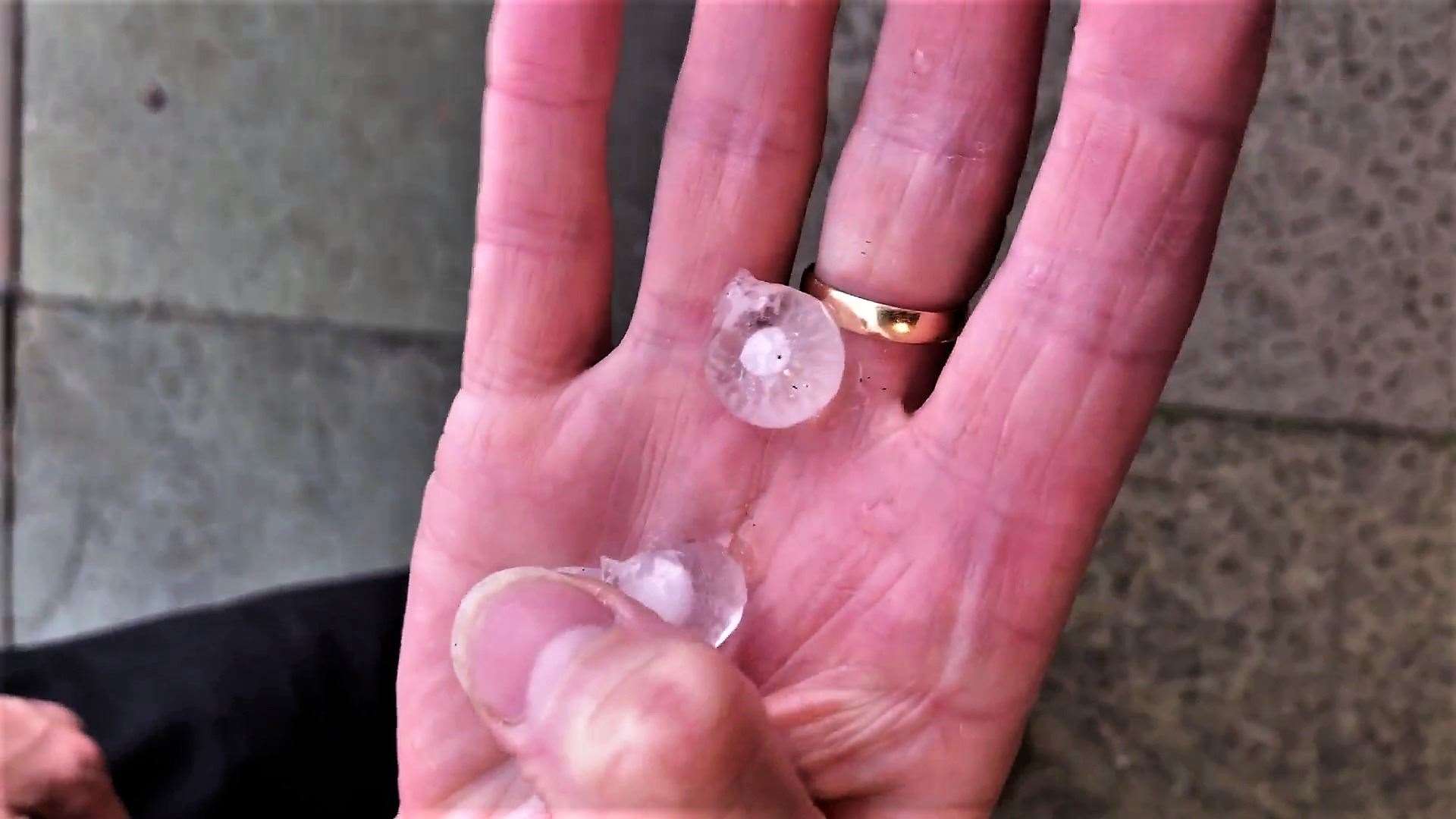


Neil managed to capture some video footage of the storm and Elizabeth can be seen picking up some of the hailstones which appear to have a central core surrounded by ice. They resemble transparent snail shells in her hand and have a radiating pattern within.
After the hail there was an "almighty deluge" of rain, he said.
"I do know that it was forecast as we were debating whether we'd go down.
"It was sunny to start so we thought we'd take a chance. It all seems very localised as one of my colleagues from the heritage centre lives on the edge of the village and didn't get any of the hailstones or heavy rain. There was a lot of thunder but there was only one [lightning] flash."
There was flooding along some streets in Thurso's town centre with Princes Street reported to be especially affected. More videos posted online appear to show the entrance of Thurso railway station flooded by rainwater.
Halkirk also experienced heavy rain along with other areas in the west of the county but Watten was dry on the whole and along with Wick had periods of prolonged sunshine.
Wick weather watcher Keith Banks said: "Today, a cluster of cumulonimbus clouds, propagated by low pressure coupled with convergence, and intense heating of the land, generated vigorous convective activity in a moist and unstable air mass.
"A funnel cloud, often referred to as a 'twister' was observed. Conditions were optimal for the development of this meteorological feature. When strong convection exists within a cumulonimbus cloud, it sometimes produces a rotating column of air that descends towards the ground . Typically, this manifests as a grey or blueish/grey funnel cloud, sometimes called a tuba.
"In the majority of cases funnel clouds do not reach the surface of the land or sea. However, if the funnel does make contact with the Earth's surface it is known as a landspout. Alternatively, if the tuba connects with the sea it is called a waterspout.
"Landspout and waterspout phenomena are not uncommon. They are probably under recorded, probably because they tend to be short-lived features. Land and and waterspouts are potentially dangerous and can cause damage. However, they are weaker than tornadoes, which are propagated by a completely different mechanism associated with so called 'super cell storms'."

He added that today was a classic example of the localised or "hit or miss" nature of convective or showery precipitation.
"It was a bonnie summer's day in Wick – dry with unbroken sunshine and a warm afternoon with the thermometer reading 18.2C at 3pm. However, it was a different world in Thurso. Lightning coupled with the cocophony of thunder."