


Temperatures to jump to as high as 14C on Monday after cold snap
Register for free to read more of the latest local news. It's easy and will only take a moment.
Temperatures are expected to jump by 15 degrees or more across the UK after days of severely cold and icy weather.
The recent cold snap will be replaced with warmer temperatures due to milder air coming in from the Atlantic.
Daytime maximum temperatures across the UK on Monday will range from 11C to 14C – in stark contrast to the chilly temperatures recorded over the last week.
On Tuesday, the mercury plunged to minus 17.3C in Braemar in Scotland – the coldest temperature since February 11 2021.
On more recent nights, other places around the country have recorded lows of minus 10C to minus 15C.
Met Office forecaster Marco Petagna said both daytime and night-time temperatures are expected to increase over the next couple of days.
He told the PA news agency: “At the moment daytime temperatures are low single figures, and in places are staying below freezing under snow cover, so some areas are just a little bit below zero.
“But daytime temperatures by Monday, we’re looking at across the UK highs of 11C to 14C, so around about 15 degrees certainly higher than they’ve been.”
Mr Petagna said people can expect a leap of “15 degrees or more” as some snow-covered spots could see an increase of more than 15 degrees.
On Saturday temperatures in Aberdeen are expected to hit a high of 2C, rising sharply to 12C or 13C on Monday.
In London, temperatures on Saturday were expected to hit a high of 5C, while on Monday they could hit 14C.
Mr Petagna said cold wind has been coming down from the north in the last week or 10 days, but this week winds are going to start coming in from the west or south west.
“So it’s bringing milder air off the Atlantic, rather than coming down from the Arctic,” he said.
Mr Petagna said it is not unheard of to get temperatures in the low teens at this time of year, but said the contrast of going from very cold to very mild in a day or two is quite unusual.
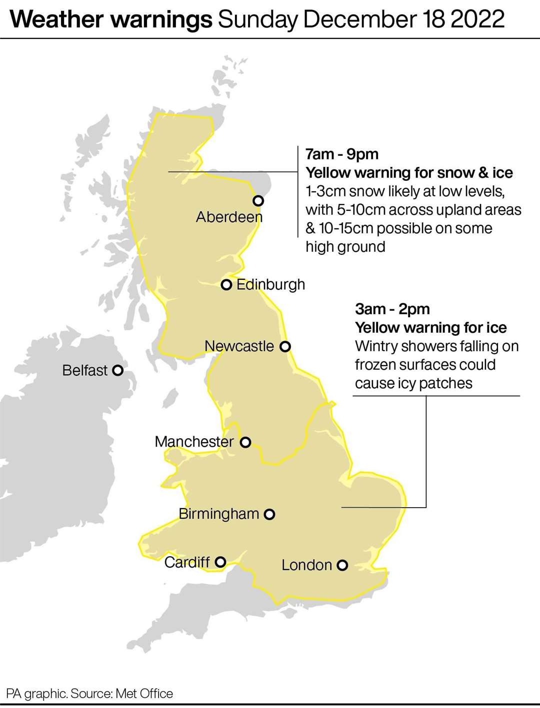
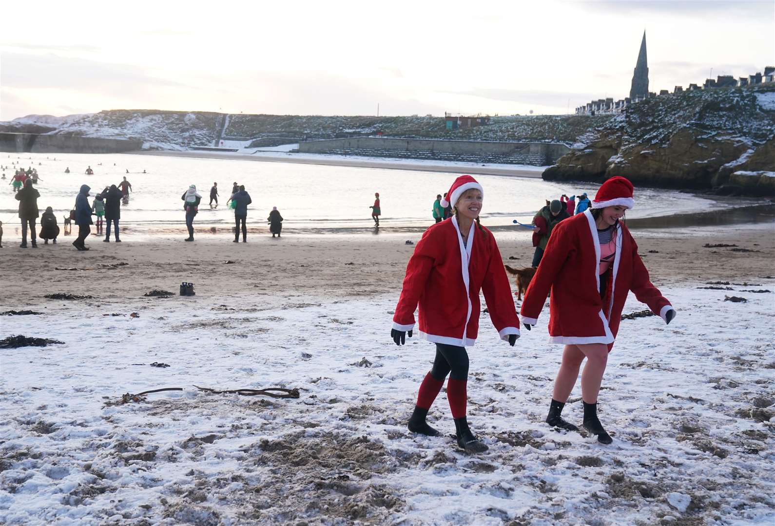
Meanwhile, weather warnings for ice and snow are in place for the weekend before blizzards are expected to sweep across the north of the country.
The Met Office has issued a yellow warning for ice for parts of northern Scotland from 4pm on Saturday.
On Sunday there are a number of yellow warnings for snow, ice and rain around Britain, as well as an amber warning for ice which covers north east and north west England, East Midlands, West Midlands and Yorkshire and Humber from 9am to 8pm.
In Northern Ireland there is a yellow warning for ice and fog in place until 6am on Sunday.
A level three cold weather alert was earlier issued by the UK Health Security Agency (UKHSA) for all of England until midnight on Sunday, which it warns could “increase the health risks to vulnerable patients and disrupt the delivery of services”.
Met Office deputy chief forecaster Helen Caughey said: “The northerly airflow and cold conditions which have dominated our weather patterns over the last 10 days will start to lose ground to a push of mild air from the south-west on Sunday.
“As the mild air meets the cold air currently in situ over the UK there will be a transient spell of snow, potentially to low levels, especially in the north.
“Add to this the risk of rain falling on to frozen surfaces, and strong winds over upland areas of northern Britain, bringing blizzard conditions, and this could be a day to avoid travelling in some areas, although the snow should turn to rain later.
“There is also a brief risk of a period of freezing rain most likely to impact areas from the Pennines northwards, which could result in some power interruptions.”
Ms Caughey said cold temperatures were likely to return next week but it was still too early to say whether there would be a white Christmas.
Peter Jenkins, director of campaigns at Water UK, advised that the rise in temperature could cause burst pipes.
He said: “The recent freezing weather has been very disruptive to many people.
“The last thing we want is for people to experience further disruption as temperatures rise this weekend, putting many homes at risk of burst pipes due to freeze-thaw.
“That’s why we’re urging everyone to check their water pipes are well insulated now and to follow our simple tips to protect homes against weather conditions.”