


Milder conditions on the way after wintry weekend
Milder conditions are on the way after a week of record-breaking cold, according to the Met Office.
Wintry weather will still be around for the weekend, but temperatures will begin to rise towards double figures into next week, forecasters have predicted.
Yellow weather warnings for snow and ice are in place across most of Scotland and parts of northern England and Wales on Saturday, and again on Sunday, as well as eastern parts of Northern Ireland.
Blizzards are forecast to sweep across Northern Ireland on Saturday, with wind speeds reaching 40mph in coastal areas.
Met Office forecaster Luke Miall said: “Blizzard conditions will really significantly reduce visibility when driving. We have gusts in the region of 35mph to 40mph on the coast and nearly 30mph inland.”
Loch Glascarnoch, near Garve in northern Scotland, recorded the lowest temperature in the UK on Friday night at minus 6.5C
The mercury dropped to minus 5.8C overnight at Pennerley in Shropshire, minus 5.6C at Parc Bryn Bach in Tredegar, South Wales, and minus 1.7C in Killylane, Co Antrim, Northern Ireland.
Chief meteorologist at the Met Office, Neil Armstrong, said: “For the past week the UK has been in a very cold airmass with temperatures well below average, this will change through the weekend as milder air moves in from the Atlantic and pushes that cold airmass out into the North Sea.
“Where temperatures were close to freezing in many places last week, we could expect to see 11C or 12C next week.
“There are still some wintry hazards to get through over the next few days, with low temperatures, strong winds and further snow especially in Northern Ireland.”
He added: “On Sunday there is a risk of freezing rain over the high ground in Scotland and northern England, with further snow in the Scottish hills, before turning to rain as the warm air takes hold.”
The coldest UK temperature for 65 years was recorded at Braemar in Aberdeenshire on Wednesday night, when the mercury dropped down to minus 23C.
A record low temperature for February was also recorded in England and Wales when temperatures in Ravensworth, North Yorkshire, dropped to minus 15.3C overnight on Thursday.
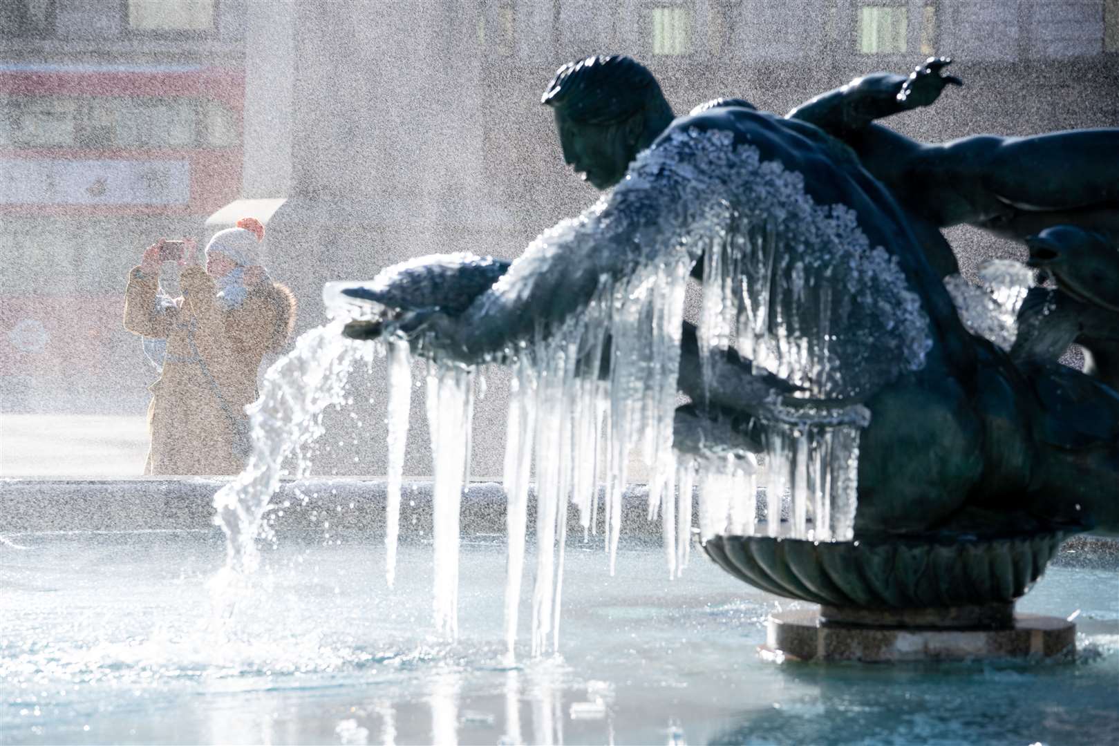
The chilly conditions have frozen Trafalgar Square’s fountains and brought large amounts of snowfall to regions across the country.
Parts of the Thames also froze over in the south of the capital, with the RNLI sharing an image of the ice in Teddington.
Public Health England (PHE) has extended its cold weather alert through the weekend and has urged people to check on vulnerable relatives and neighbours.
Dr Owen Landeg, group leader for extreme events and health protection at PHE, said: “Cold weather can have a serious impact on health, particularly for older people and those with heart and lung problems, as it increases the risks of heart attacks, strokes and chest infections.
“Make a call, or socially-distanced doorstep visit if they live close by, to remind them to heat their home to at least 18C, 64.4F, and to keep up to date with the forecast.
“It’s also helpful to check they have enough food and drinks and any medicines they need.”