


Met Office warns of frequent snow showers causing travel disruption in Caithness this week – possible 20cm deep snow predicted for some areas
Register for free to read more of the latest local news. It's easy and will only take a moment.

The Met Office has warned of heavy and frequent snow showers across Caithness and northern Scotland until Thursday that could lead to deep snow in areas.
The bulletin states that snow showers are likely to continue during Wednesday night and well into Thursday.
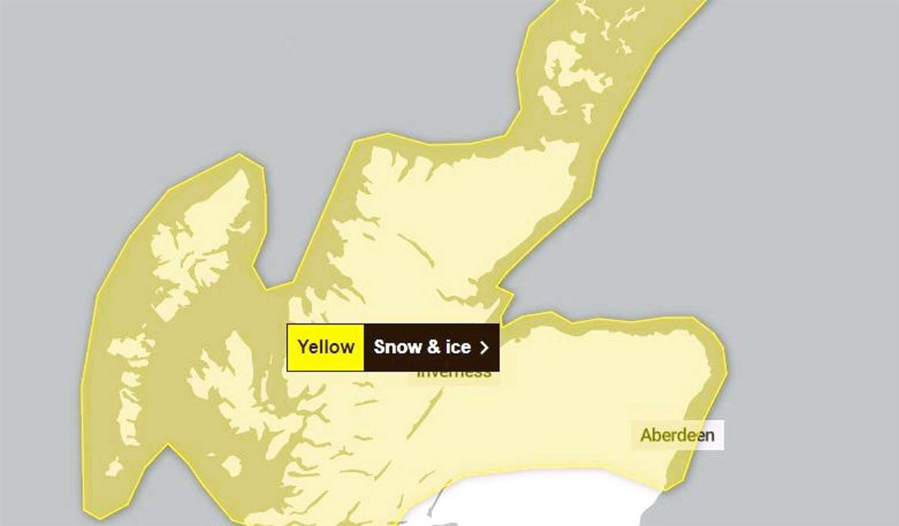
It continues: "Whilst accumulations will vary due to the nature of showers, 2-5cm of snow is expected in many places. Where showers become more organised, there is a chance some low-lying areas could see 10cm in a few hours.
"Across northern Scotland over 20cm of snow could build up in a few locations."
Advice
Snowy, wintry weather can cause delays and make driving conditions dangerous, so to keep yourself and others safe: plan your route, checking for delays and road closures, amending your travel plans if necessary; if driving, leave more time to prepare and check your car before setting off; make sure you have essentials packed in your car in the event of any delays (warm clothing, food, water, a blanket, a torch, ice scraper/de-icer, a warning triangle, high visibility vest and an in-car phone charger).
People cope better when they have prepared in advance for the risk of power cuts or being cut off from services and amenities due to the snow. It’s easy to do; consider gathering torches and batteries, a mobile phone power pack and other essential items. Be prepared for weather warnings to change quickly: when a weather warning is issued, the Met Office recommends staying up to date with the weather forecast in your area.
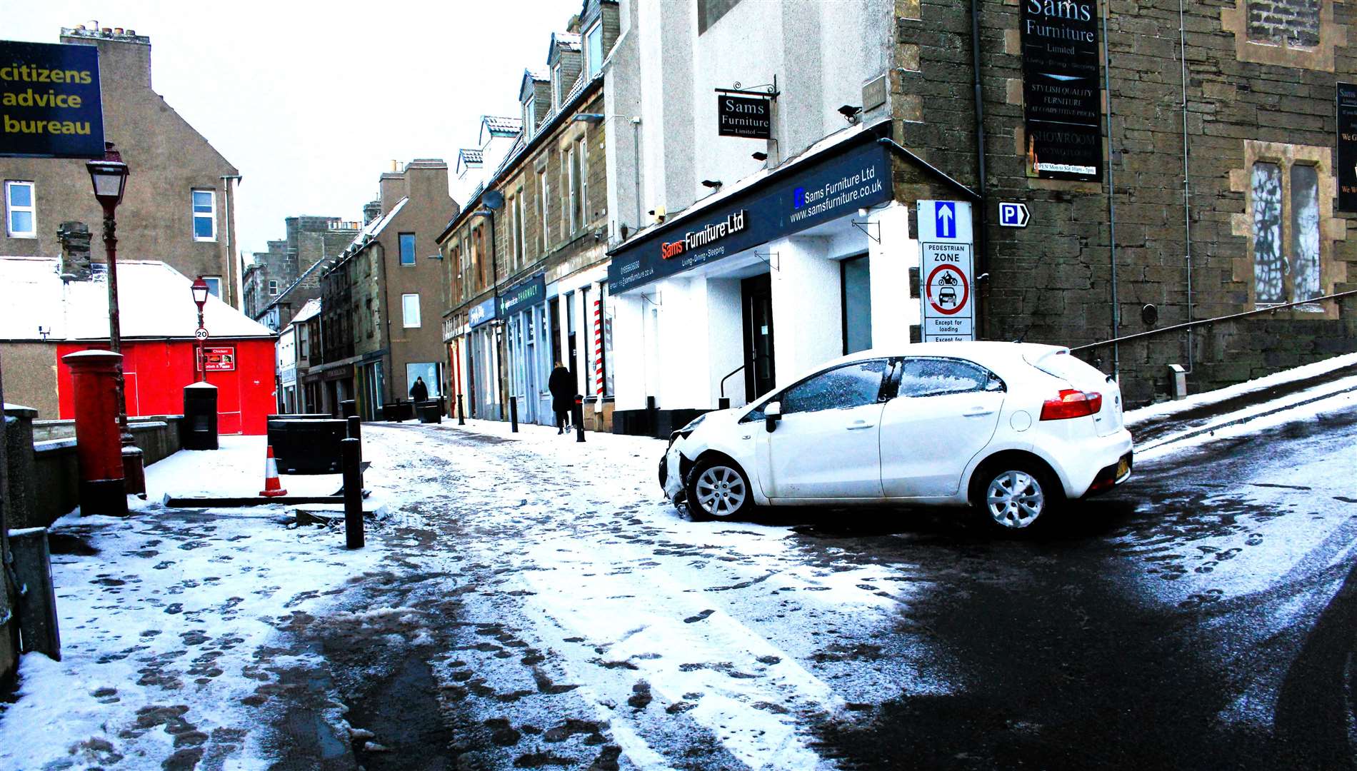
In Wick, the eastern entrance to High Street was partially blocked this morning by a car that appeared to have slid in the snow at the foot of Shore Lane and collided with a large "pedestrian zone" sign. There was damage to the front of the vehicle, a white Kia hatchback, and the sign was flattened.
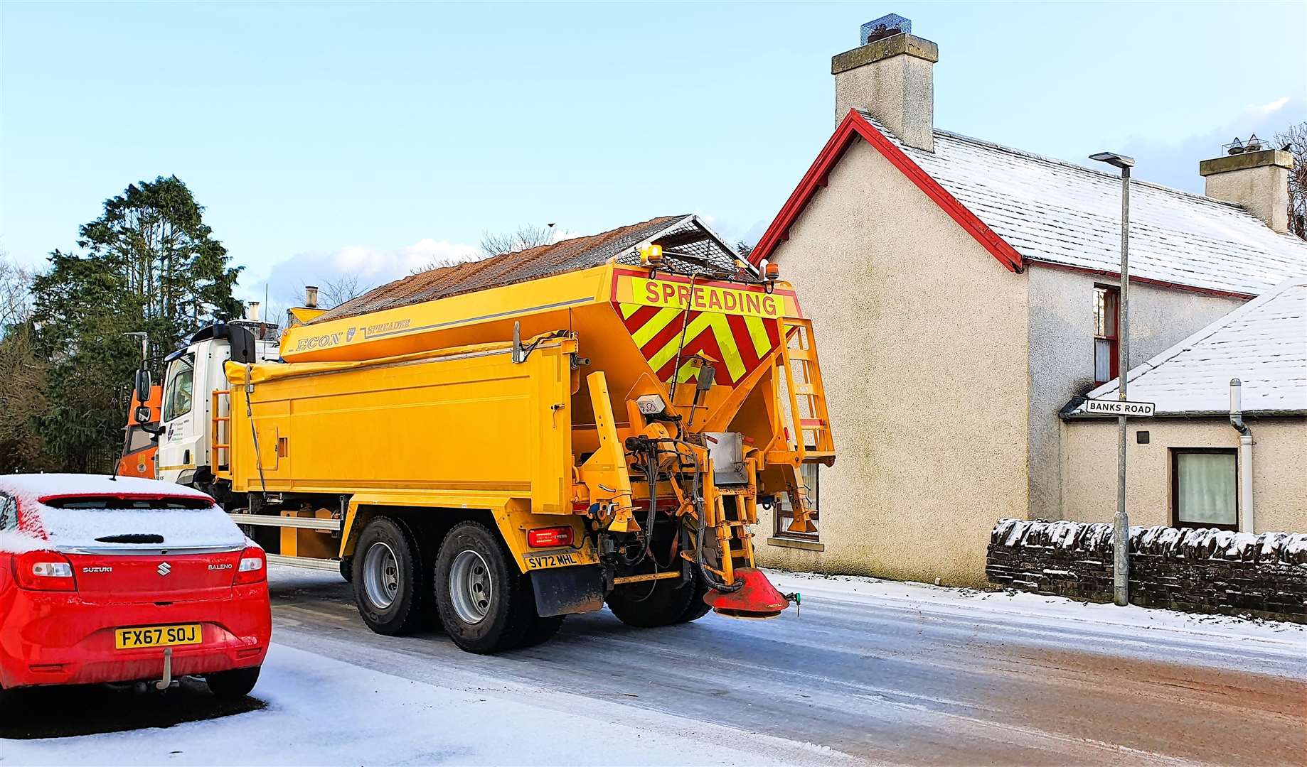
Highland Council's road condition report for Caithness, issued at 8.19am today, stated: "Negative temperatures this morning with with strong winds and snow showers affecting all routes. Treatment is ongoing this morning. No known overnight issues to report."
The Sutherland status said: "The B9176 Struie Road between Ardgay and Ardross at 6:30am had six inches of snowfall with drifting of up to 18 inches in places.
"This has been bladed and treated early and a return visit will take place. Care is advised if driving this route. Snow and ice is affecting all areas this morning. Higher inland routes have up to six inches of snowfall which is drifting in the wind creating drifts of up to one foot in exposed areas. The A836 Lairg to Tongue road is currently the worst affected location."