


How starlight can help you forecast the weather
Register for free to read more of the latest local news. It's easy and will only take a moment.

Weather Watch by Keith Banks
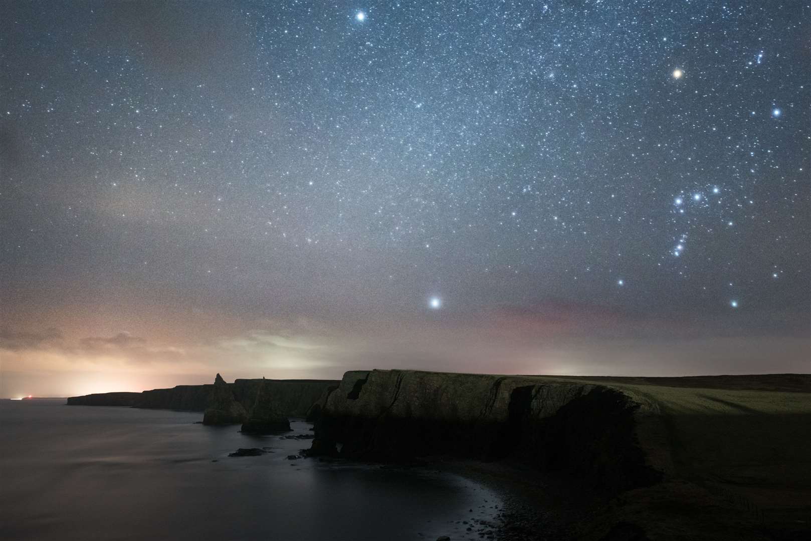
When darkness falls the planets and the stars become visible. The planets are the most striking heavenly bodies that can be observed amongst individual fixed stars, together with the myriad of stars that make up the Milky Way.
The planets reflect the light from the Sun; however, the stars produce their own light. The extent that the planets and the stars are visible depends upon the absence of sunlight, and also the transparency of the Earth's atmosphere.
The presence of water vapour, clouds, mist and fog, together with air disturbances, contribute to reduce the clarity of the planets and stars. The luminosity of a group of stars is a reliable indicator, in terms of the amount of moisture that is present in the atmosphere. The twinkling of stars betrays atmospheric turbulence.
The stars sparkle because of differences that occur in the temperature and the density of the atmosphere. The shimmering is most noticeable when the atmosphere is very disturbed, which can be a precursor to a change in the weather.
Unwavering, fixed starlight, coupled with good visibility, are indicators of stable atmospheric conditions, typically associated with areas of high pressure.
September 2022 was Wick's coolest since that of 2020. However, perusal of the town's historic archive for mean air temperature for a series of Septembers stretching back to 1910, showed that it is currently the 16th equal mildest. The mean was identical in September 2017.
In terms of precipitation, September 2022 was town's least wet since that of 2020, and is presently the 48th driest in a series of Septembers commencing from 1910.
Wick's mean air temperature for September 2022 was 12.22C (54.0F). The long-term average, in terms of the averaging period 1991-2020, is 11.79C (53.22F).
Wick's average daytime maximum air temperature for the month was 14.78C (58.60F). The long-term average for the current 30-year averaging period is 14.68C (58.42F).
Highest maximum was 17.5C (63.5F), observed on September 22.
The lowest maximum was 10.4C (50.7F), witnessed on September 26.
The royal burgh's average overnight minimum air temperature was 9.66C (49.39F). The long-term average for September is currently 8.89C (48.0F).
The highest overnight minimum was 14.4C (57.9F), recorded on September 5 and 7 respectively.
The lowest overnight minimum air temperature was 2.1C (35.8F), logged on September 19.
Lowest temperature recorded at 5cm over the grass was 0.1C (32.2F), recorded on September 19.
Precipitation was measurable on 27 dates. The total for the month was 75.2mm (2.96 inches), or 113.5 per cent of the long-term average for September.
Wettest day was September 30. The amount recorded for the 24 hours commencing 9am (GMT) was 15.4mm (0.61 of an inch).
There were no "days of gale" during the month. However, wind velocities reached or exceeded gale force 8 (39.0mph/33.9knots), on three dates.
The highest wind velocity was experienced during the hour ending 10am (GMT) on September 30, when a force 7 southerly wind gusted up to 51.8mph/45.0knots, severe gale force 9 on the Beaufort scale.