


Highland snow warning upgraded to amber as heavier snow and drifts forecast
Register for free to read more of the latest local news. It's easy and will only take a moment.

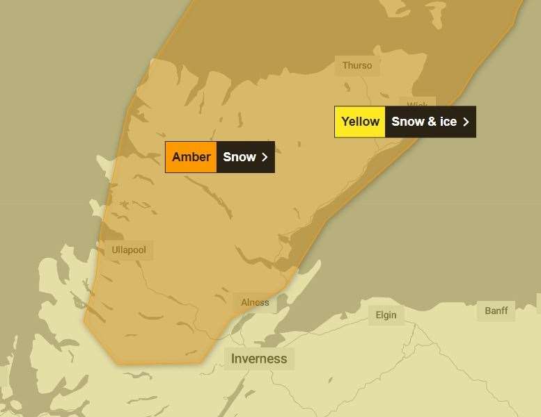
Even heavier snowfalls are being forecast for parts of the Highlands after the Met Office upgraded its weather warning for the region to amber.
The existing yellow alert, which covers the whole of the Highlands, was joined by an amber alert on Wednesday morning – ahead of forecasts for up to 20cm of additional snowfalls in some places.
The amber alert comes into force at 3pm on Wednesday and covers all of Caithness, Sutherland, as well as large swathes of Ross-shire.
- Related: SNOW UPDATE: More than 100 schools across the Highlands to remain closed after heavy snowfall
- Related: SNOW UPDATE: Stagecoach suspends Highland bus services as heavy snowfall brings further travel disruption
- Related: 'Considerable' avalanche risk on Highland mountains, as warning level raised
Announcing the amber warning, a Met Office spokesperson said: "Further frequent, occasionally heavy, snow showers will affect the Northern Isles and northwest Scotland through Wednesday evening and Thursday with an additional 5-10 cm of snow likely, and the potential for a further 15-20 cm of snow in a few locations.
"In addition strengthening northerly then northwesterly winds will cause lying snow to drift."
The amber warning, which also extends across Orkney and Shetland, will remain in place until 6pm on Thursday.
The wider yellow warning for snow and ice that is currently in force across all of the Highlands, is expected to remain in place until the very end of Thursday.