


Flood warning issued for parts of Caithness
Register for free to read more of the latest local news. It's easy and will only take a moment.

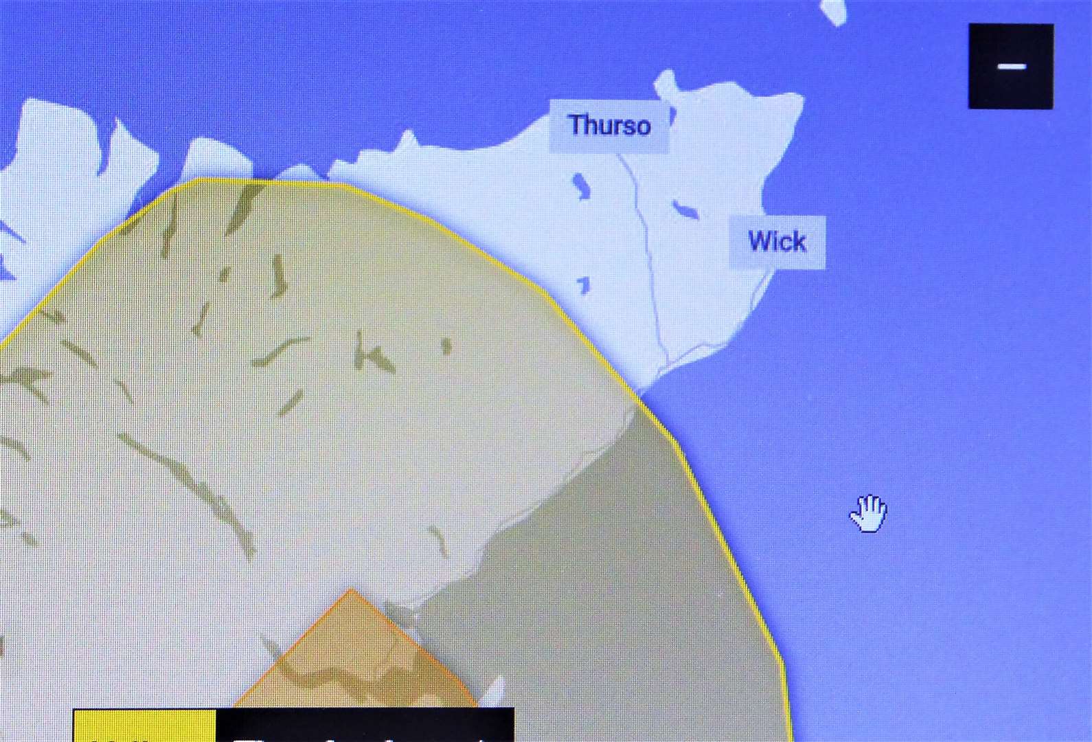
After the Met Office issued an amber warning for the Highlands, the country's environmental regulator now has a flood warning in place for parts of Caithness.
The Met Office bulletin issued today said that areas of heavy rain along with some thunderstorms will continue to move north and west across the warning area during this afternoon and evening. Hourly rainfall accumulations of 20 to 30 mm are likely in places, and locally totals of 60 to 80 mm in a few spots by the end of the day. Surface water and disruption to transport is likely.
David Faichney, duty flooding manager with the Scottish Environment Protection Agency (SEPA), said: “More heavy rainfall is likely to come this afternoon and into Thursday. While impacts have been felt around the country already, the areas most likely to be worst affected later today are Findhorn, Moray, Nairn and Speyside, Easter Ross and the Great Glen, Wester Ross and parts of Caithness and Sutherland – although other areas could see heavy rainfall too.
“Due to the nature of thundery showers, it’s hard to pinpoint exactly where will be worst hit, but what we do know is that it can happen quickly and can be highly localised.
“It’s important that those out and about, holidaying, engaging in activities near rivers and streams or out hillwalking are aware of the hazards and stay safe. Some rivers and streams can rise to dangerous levels very quickly, so avoid camping near water and be very mindful of conditions if considering activities such as swimming or canoeing.
“Sixteen regional flood alerts and three flood warnings have been issued, and people living and working in affected areas are advised to plan their journeys and consider the steps they need to take now to be prepared, including keeping flood protection products, like sandbags, in place in high risk areas. You can stay up to date with regional flood alerts and local flood warnings at sepa.org.uk/floodupdates.
“Extreme weather such as prolonged heavy rain following a period of warm, dry weather, is something we will see more of as our climate changes and these patterns become more common in the future.
“SEPA is working 24/7 to monitor rainfall and river levels and is in close contact with the Met Office and other partners to review the forecasts, which are combined with local expertise from all regions of Scotland to understand and present the flooding risk. We would encourage the public to remain vigilant, especially in isolated, low lying agricultural areas susceptible to flooding. The most up-to-date information is always available on our website.”
Thunderstorms
Thunderstorms can cause very intense and localised torrential downpours, with potential dangerous flash flooding impacts.
It is very hard to predict where exactly impacts may be experienced; it can also happen suddenly, so it is important you are prepared and remain vigilant.
It is your responsibility to take action to protect yourselves and your property against flooding, for information on how to prepare visit www.floodlinescotland.org.uk
Be careful on the roads. Spray and sudden flooding can lead to difficult driving conditions. You should not drive through flood water.
Staying informed
All SEPA’s Alerts and Warnings are available on its website at sepa.org.uk/floodupdates
Floodline is always the most up-to-date information – with any new flood updates available as soon as they are issued.
Advice on what you can do to prepare for flooding can be found at floodlinescotland.org.uk
Be prepared and stay safe
Check Floodline – visit sepa.org.uk/floodupdates
Don’t walk through flood water – 15cm of fast flowing water could be enough to knock you off your feet and hazards can be hidden under the water.
Drive with care, and do not travel through deep fast flowing water. It only takes 30cm of fast flowing water to move an average family sized car.
If you are walking beside rivers be extra careful of wet footpaths and possibly small watercourses in spate.
Please consider deploying flooding protection products if required.
What’s the difference between a Flood Alert and a Flood Warning?
SEPA uses forecast weather information provided by the Met Office combined with its own observation of rainfall and river levels and advanced hydrological modelling to provide advance warning of flooding.
Regional Flood Alerts are early advice that flooding is possible across a wider geographical area. The purpose of the Alerts is to make people aware of the risk of flooding and be prepared. We normally issue them 12 to 24 hours in advance of the possibility of flooding.
Flood Warnings are more locally specific and are issued for areas where we have gauges on rivers to measure the exact river height. They are issued at shorter notice when we are more certain that a specific area will be affected.
Related article:
Council advises Caithness residents to prepare for flash floods and power outages