


Most schools closed and ferry services cancelled as Caithness feels the force of Storm Arwen
Register for free to read more of the latest local news. It's easy and will only take a moment.

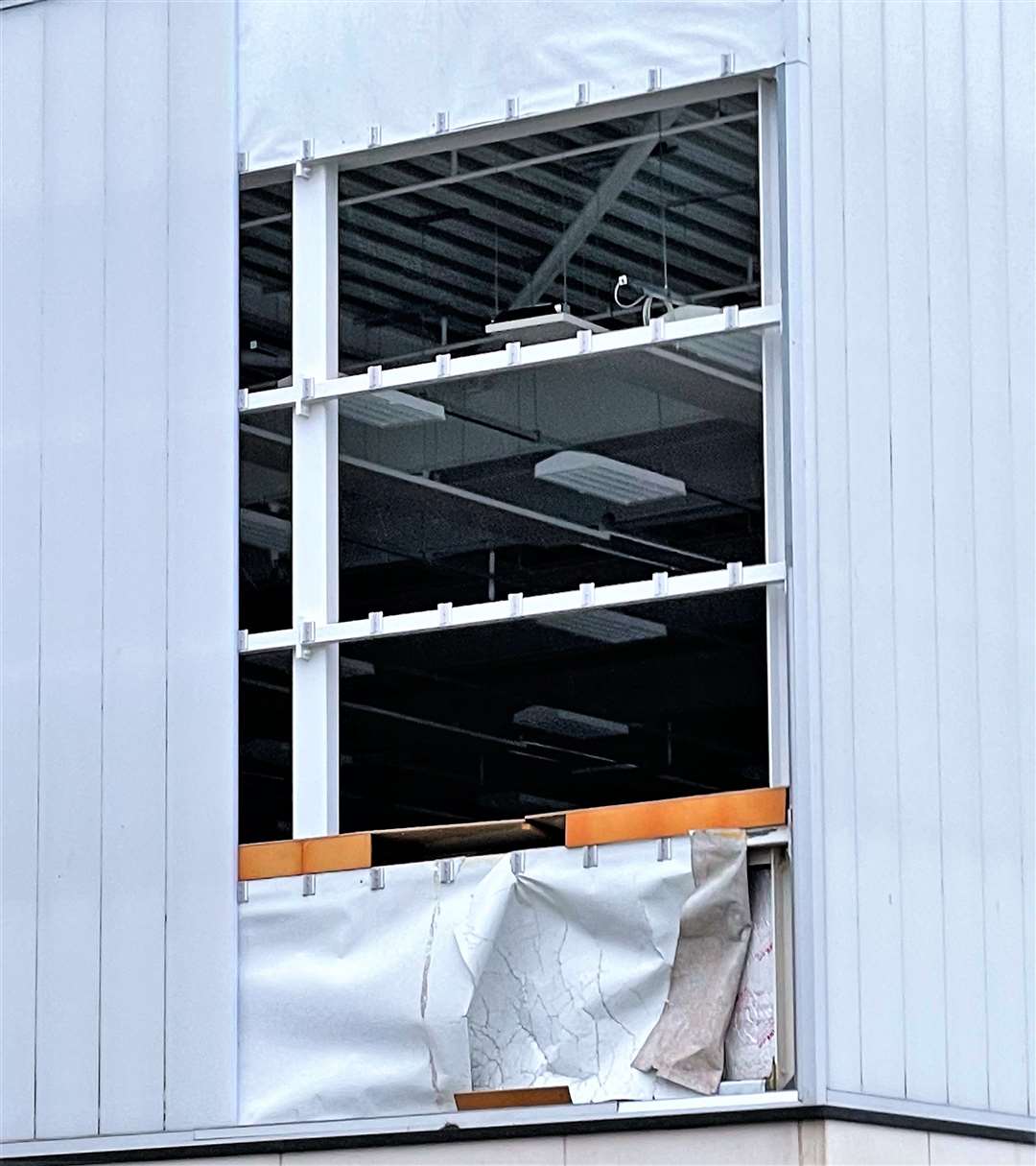
Most schools have been closed as Storm Arwen blasts its way across the far north, with damage reported at the Wick High games hall.
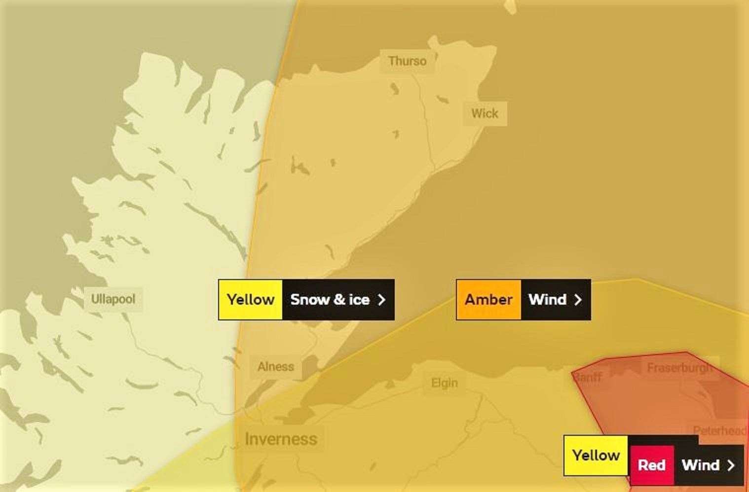
It is on course to be the strongest gale to affect the county for almost seven years and conditions are likely to worsen as the day goes on, with winds of up to 80 mph expected in some parts of the Highlands.
An amber warning was issued for northern and eastern Scotland from Orkney down to the Borders from 3pm on Friday to 9am on Saturday.
Highland Council is advising residents to ensure that all trampolines, outdoor garden furniture and outdoor Christmas decorations are securely tied down.
Ferry companies NorthLink and Pentland Ferries have cancelled all their Pentland Firth sailings for Friday, with sailings for Saturday under review.
ScotRail said train speeds would be limited for safety reasons on journeys between Inverness and Wick/Thurso from noon today, and on Inverness/Aberdeen services from 2pm today. These will apply until the end of the day.
Dounreay is understood to be closing to everyone except essential workers from 3pm.
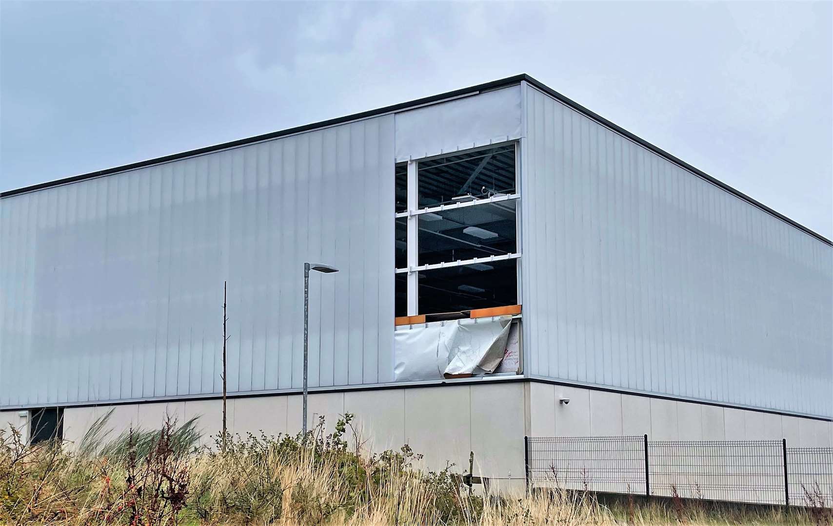
Wick High School issued a statement saying: "Due to the high winds currently experienced in Wick and due to some damage caused to the school building we have taken the decision to close the school earlier than planned today.
"Town pupils will be allowed to go home from 10.45am. It would be preferable for their safety if an adult could pick them up.
"Pupils taking buses home will remain in classes with their teachers until their bus arrives."
Other school and nursery closures include Bower, Canisbay, Castletown, Crossroads, Dunbeath, Farr, Keiss, Lybster, Melvich, Miller Academy, Newton Park, Noss, Pennyland, Reay, Thrumster, Tongue and Watten.
A tree was blown down near the Miller Academy school gate on Princes Street, Thurso.
Wick weather watcher Keith Banks, who contributes a monthly column to the John O'Groat Journal, said this morning: "Storm Arwen is hitting us hard. Mean wind speed has increased to severe gale force 9, with a peak gust so far in Wick up to 73mph – that's just 1 mph short of hurricane force 12."
"Arwen will continue to savage Caithness, and I believe conditions will deteriorate as the day progresses. Provisionally, Arwen is shaping up to be our most notable gale since January 9, 2015."
Highland Council advised motorists to drive according to the conditions and limit journeys to essential travel where possible.
Landowners are also being reminded about the danger of fallen trees.
Colin Howell, the council's head of roads and infrastructure, said: “Damaged trees and vegetation can cause potential hazards to road users by obstructing the passage of vehicles and pedestrians. The council is particularly concerned where weakened or damaged branches could subsequently fall on vehicles or pedestrians.”
Anyone affected by falling trees can seek advice and guidance by calling the council’s service centre on 01349 886601.
The Met Office said: "Areas exposed to the north-east are likely to see strongest winds, with the potential of travel delays, road and rail closures, power cuts and a potential risk to life and property.
"In addition to the strong winds, snow will primarily affect high ground during Friday afternoon and evening, although there could be some sleet/temporary snow at lower levels in the north of Scotland. The combination of snow and strong winds will bring some very difficult travel conditions.
"The public are encouraged to take sensible precautions prior to and during severe weather events and to visit Ready.Scot for information."
Scottish and Southern Electricity Networks (SSEN) said the intensity of the weather system had the potential to cause a number of faults across its network area. SSEN’s customer service teams are contacting customers on its Priority Services Register to offer extra assistance, where required.
Mark Rough, director of customer operations at SSEN, said: “We’ve been monitoring the weather for a number of days now and we’d like to reassure our customers we’re well prepared. We’re moving teams of engineers to locations expected to experience the worst of the conditions, including the islands, to ensure we’re ready to respond as soon as it’s safe to do so.
“We’re proactively contacting customers on our Priority Services Register, but I’d encourage anyone concerned about any potential disruption to power supplies to give our dedicated teams a call on 105, where we can provide additional support and guidance to help you prepare.”
SSEN is urging people to not approach any damage to its equipment and instead report it to SSEN by calling 105 or via its Power Track app and engineers will investigate as soon as possible.