


Earth's atmosphere colours our view of light from the sun
Register for free to read more of the latest local news. It's easy and will only take a moment.

Weather Watch by Keith Banks
Different cloud forms are, in general, indicative of different types of weather, and related to atmospheric motion. The optical effects that are produced are essentially circumstantial, or incidental events, that are provided by the rays of the sun shining on or through water droplets, ice crystals, or the minute solid particles present in the atmosphere.
However, the most salient of all of these effects is the perceived blue colour of the sky itself, during the daytime, and it is the existence of the atmosphere that is responsible for this phenomenon known as Rayleigh scattering.
This scattering is evidence of the change in direction of motion of the short blue wavelength light that forms part of the visible portion of the electromagnetic radiation spectrum that has originated from the sun.
Rayleigh scattering is caused by the effect of atoms and molecules of oxygen and nitrogen that account for the just over 99 per cent of the composition and mass of the Earth's atmosphere.
Crucially, these atoms and molecules of air are smaller than the wavelength of the electromagnetic radiation that they interact with, and that we perceive as the colour blue. Violet radiation actually has a shorter wavelength than blue, and as a consequence it gets scattered more than the blue. However, the human eye is more sensitive to the blue than it is to the violet, and that is the reason why the sky appears blue.
If the Earth had no atmosphere, then the sky would be black, and the sun would appear a brilliant white disc.
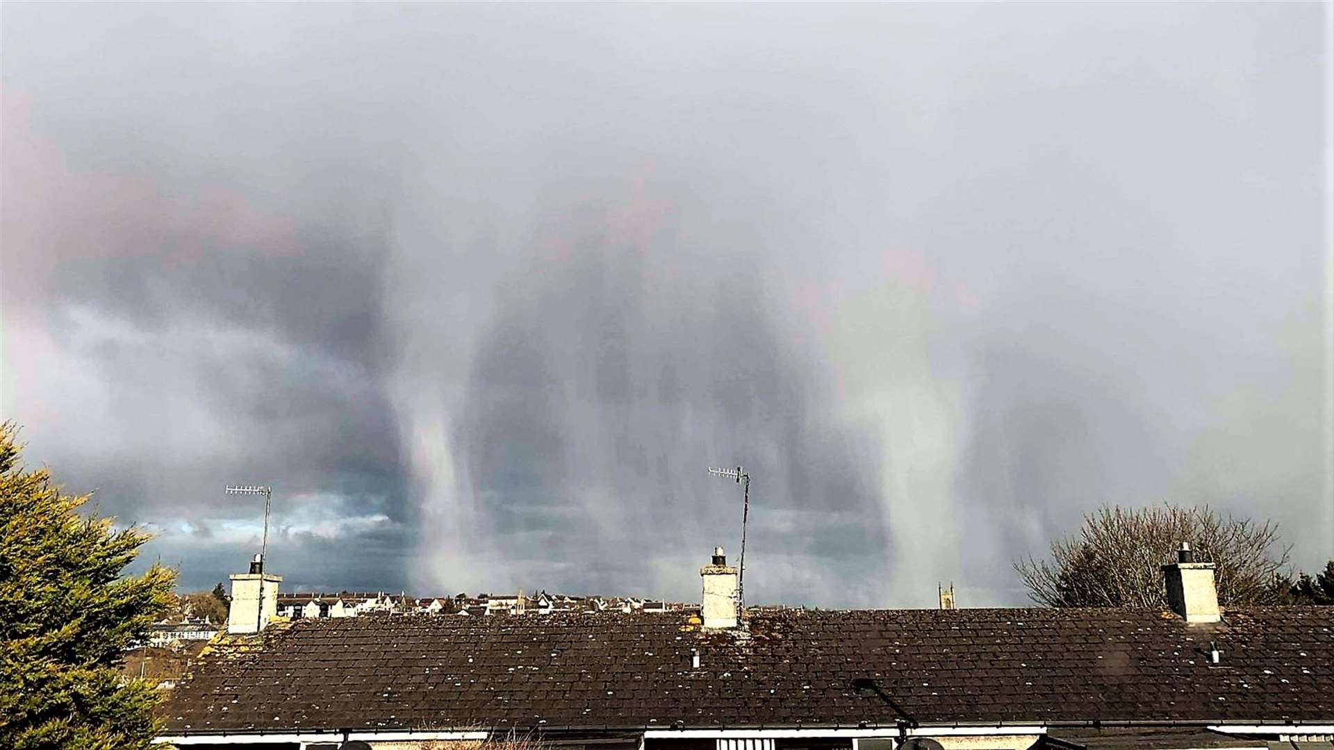
The sun can look fiery orange or red when light travels through air that contains dust, pollutants, and water droplets, scattering light in all the wavelength bands. When this happens, the rays that reach the eye are all in the longest wavelengths; the oranges and the reds. The longer the journey through the atmosphere, the greater the amount of scattering.
April 2021 was Wick's coldest since that of 1986. The town's record for mean air temperature for April shows that it is currently the 14th most cold in a series commencing from 1910.
Last month was Wick's most wet April since that of 2019. However, the royal burgh's precipitation annals for April attested that April 2021 is presently the 15th driest in a series starting from 1910.
In terms of wind, one "day of gale" was logged.
Wick's mean air temperature for April was 4.95C (40.91F). The long-term average, in terms of the averaging period 1981-2010, is 6.55C (43.79F).
Wick's average maximum daytime air temperature for April 2021 was 8.69C (47.64F). The long-term average is 9.60C (49.28F). Highest maximum was 12.4C (54.3F), recorded on April 19. The lowest maximum was 3.2C (37.8F), observed on April 6.
The town's average overnight minimum air temperature for April 2021 was 1.21C (34.18F). The long-term average for April is currently 3.50C (38.30F). The highest overnight minimum air temperature for the month was 6.6C (43.9F), witnessed on April 27.
There were 13 air frosts. The lowest air temperature for the month was minus 4.4C (24.1F), recorded on April 11.
The temperature fell to 0.0C (32.0F), or lower, at 5cm over the grass on 20 dates. The lowest value noted over the grass was minus 6.6C (20.1F), also on April 11.
Precipitation was logged on 16 dates. The total for the month was 27.0mm (1.06 inches), or 54.1 per cent of the long-term average for April. The wettest day was April 26. The amount recorded for the 24 hours commencing 9am (GMT), was 6.2mm (0.24 of an inch). Snow was visible over the grass at dawn on six dates. On April 10 and 11 respectively, up to 2cm (0.79 of an inch) of snow was measurable.
Wind velocities reached or exceeded gale force 8 (39mph/33.9knots), on four dates, two fewer than the number that were logged during the previous month.
The strongest wind velocity observed was during the half-hour ending 1.50pm (GMT) on April 4, when a gale force 8 westerly wind gusted up to 60mph/52.2knots, storm force 10 on the Beaufort scale.