


Coastal path upgrade will be 'a huge asset' to John O'Groats area
Register for free to read more of the latest local news. It's easy and will only take a moment.

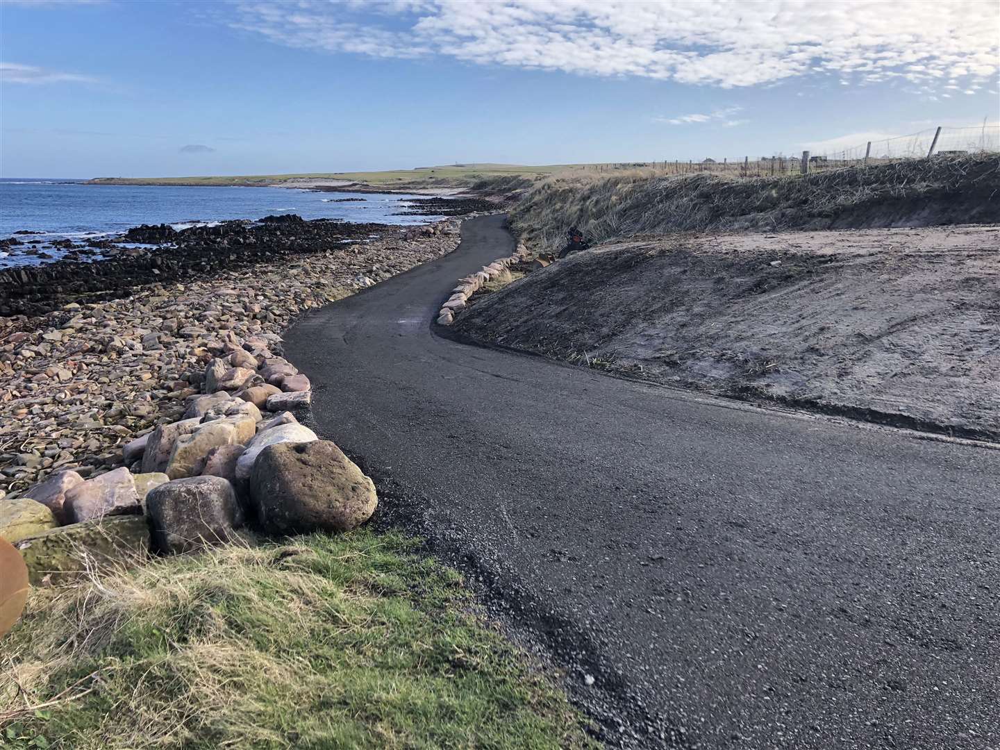
A coastal footpath at John O'Groats has undergone a transformation in the latest improvement project carried out by the local development trust.
The path leading east from the village, along the edge of the Pentland Firth, is the first section of a scenic walking route around the headland to Sannick Bay and the Stacks of Duncansby.
Over the years the path had become increasingly inaccessible because of large boulders being washed up, but the newly installed smooth surface is suitable for people of all abilities.
Andrew Mowat, treasurer John O’Groats Development Trust, is sure the upgrade will prove popular with local residents as well as giving tourists a better experience.
The new path runs for around 450 metres from the foghorn area near John O’Groats harbour. It then links in to the existing track leading to Duncansby Head.


"It is a huge asset to the infrastructure in John O'Groats and is another great project undertaken by the development trust," Mr Mowat said.
"It will help the health and wellbeing of the locals as they go out walking. It is accessible for wheelchairs and I have seen a few on it already, and that’s folk who are local to John O'Groats.
"It just really gives them a boost being able to go along the shore front. It opens up the walk to the Ness of Duncansby, the Groatie Buckie beach, and then on to Sannick and Duncansby Head.
"It will also be a benefit to the businesses as it will help increase the dwell time of visitors when they eventually are permitted to travel. It gives visitors a better experience and makes the walk much more memorable as it reinstates and tidies up an area that was not accessible to anyone.
"The walk along the shoreline is very sheltered from the south with the dunes and it feels like you are in a different world walking along with the waves breaking in to the north side."
The path has been made possible by funding from the Stroupster Wind Farm Community Benefit Fund and John O’Groats Development Fund. The latter is created from parking donations made by visitors to John O'Groats, with all the money spent directly on projects to improve the area.
Mr Mowat said the other key aspect of the path project was the expertise of local business owner Gordon Robertson, of Barrock Quarry.
"Gordon agreed to carry out the work to a very tight budget as he saw it as a huge benefit to the area," Mr Mowat said. "He went over and above our expectations to make sure he left a spectacular job.


"It is a follow-on to the foghorn and landscaping work he carried out in 2020 where he again did so much more than was required – all because he loves the community he lives in and really buys in to the overall improvement. Gordon has put community before profit and has given us a great new asset in John O'Groats."
An additional feature installed by Mr Robertson is a large piece of Caithness stone that sits in one of the inward contours of the path and can be used as a seat looking out to the Pentland Firth. Mr Robertson named this the Lovers' Stone after seeing local business owner Walter Mowat observing the progress on the path work, usually accompanied by his partner Ellen Simpson.
Andrew Mowat explained: "Gordon saw they were delighted with the new path, and were always saying how lovely it would be to just sit and look out at the sunset over Stroma, so he decided to place a stone from his quarry in the ideal spot to allow this and he thought the perfect name for it was the Lovers' Stone."
The efforts of John O’Groats Development Trust were praised by Jay Wilson, chairman of the John O'Groats Trail group which is promoting a 147-mile coastal walking route from Inverness to Caithness.
He said: "That is just the kind of model that we will be working on more and more – coordinating with local development trusts, community councils and other local groups. With 147 miles of trail we cannot really do it all ourselves."
He explained that the strategy is to encourage communities on the route to help develop paths that can be linked up along the coast.
"The John O'Groats work represents a good beginning of that process," Mr Wilson said. "We are looking to other local groups to do things like that."
Sinclair's Bay Community Council has been liaising with the group and is considering a wider path-building programme in its area, including work at Castle Sinclair Girnigoe.
He said that the whole trail had been marked from Inverness Castle to John O'Groats, involving hundreds of stiles and dozens of bridges, apart from a couple of small sections where there were access problems.
Mr Wilson added: “The work they have done at John O’Groats in what is just a matter of weeks since the winter snows disappeared has been transformative. We hugely welcome that, as it is the end and beginning of our trail at John O’Groats and our namesake village.”
Related stories: