


Beinn Ratha – as good a hill walk as any in the Highlands
Register for free to read more of the latest local news. It's easy and will only take a moment.

OUT AND ABOUT WITH RALPH: Make the most of this little hill above Reay before the turbines take over
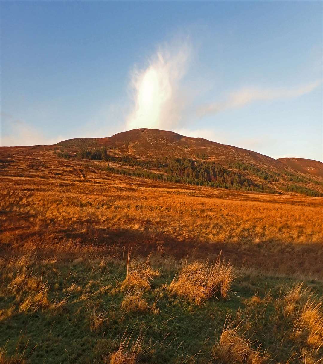
Beinn Ratha at a mere 825 feet high, is just one step up from Dorrery Hill on the scale of mini-mountains. Only from Reay does it appear significant at all. Yet the hill is not quite as easy as it looks and is regarded as one of the tougher runs on the hill-running circuit.
I like to take the track from Reay, past Achins and down the Helshetter Strath. The woods just to the west of the track used to be one of the few places in the county where you could see decent trees, but now are mostly tangled windblow with vast conifer plantations stretching beyond.
A number of years ago the estate took up a huge tree-planting scheme for the land north and east of Beinn Ratha with miles of deer fence and maybe half a million seedlings.
It never works in Caithness – the only way to grow anything other than sitka spruce is to plant each tree carefully and nurture it for the first 10 years.
There are probably no more than a thousand of the original trees alive, most of these are stunted or dying and the deer fence has been opened, allowing the animals to browse. It was a complete waste of effort and precious grant funding.
The track is little used nowadays and becoming overgrown by gorse. It emerges in a fine open glen reminiscent of the Grampians and carries on for another mile to a ruinous stables. The old woodland just beyond is a fascinating place to explore, somehow it has survived and thrived over maybe 100 years, it’s very rough and wet and a truly wild place.
This whole area will soon be completely transformed by the huge Limekiln wind farm just to the east, the turbines will reach as high as the top of Beinn Ratha.
Maybe you like the elegance of turning blades, but there is no route for taking most of the power south. On a day of brisk winds the turbines of both Baillie and Strathy North were stationary, paid to turn off. To put up yet more turbines which will be mostly idle when the winds are strong (and they should be generating most efficiently) is sheer folly, moreover it means that the energy invested in building and installing the structures will not be recouped, so adding to global warming.
Only a Byzantine funding structure which allows everyone involved to make money, except of course the electricity-bill-payer, allows this madness to continue.
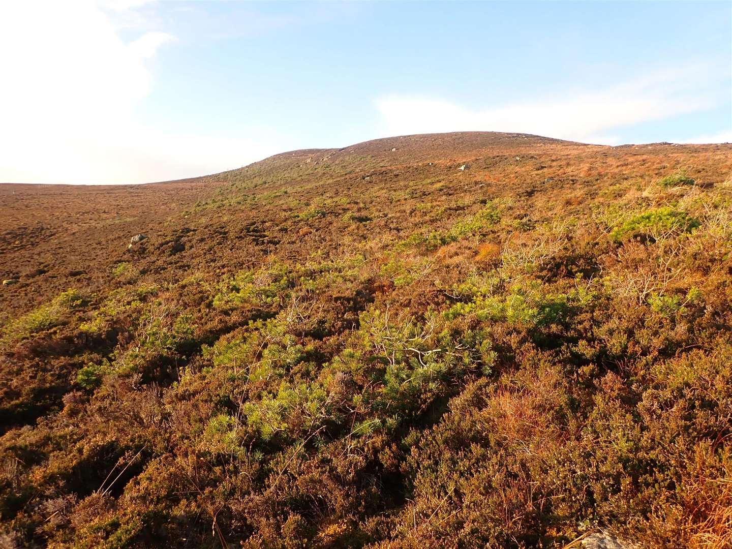
It’s a wet and pathless route up across the moor, aiming for the higher southern top. There’s a big gap in the deer fence, then you pass some bonzai Scots pine which somebody presumably expected to grow into fine trees in this exposed location.
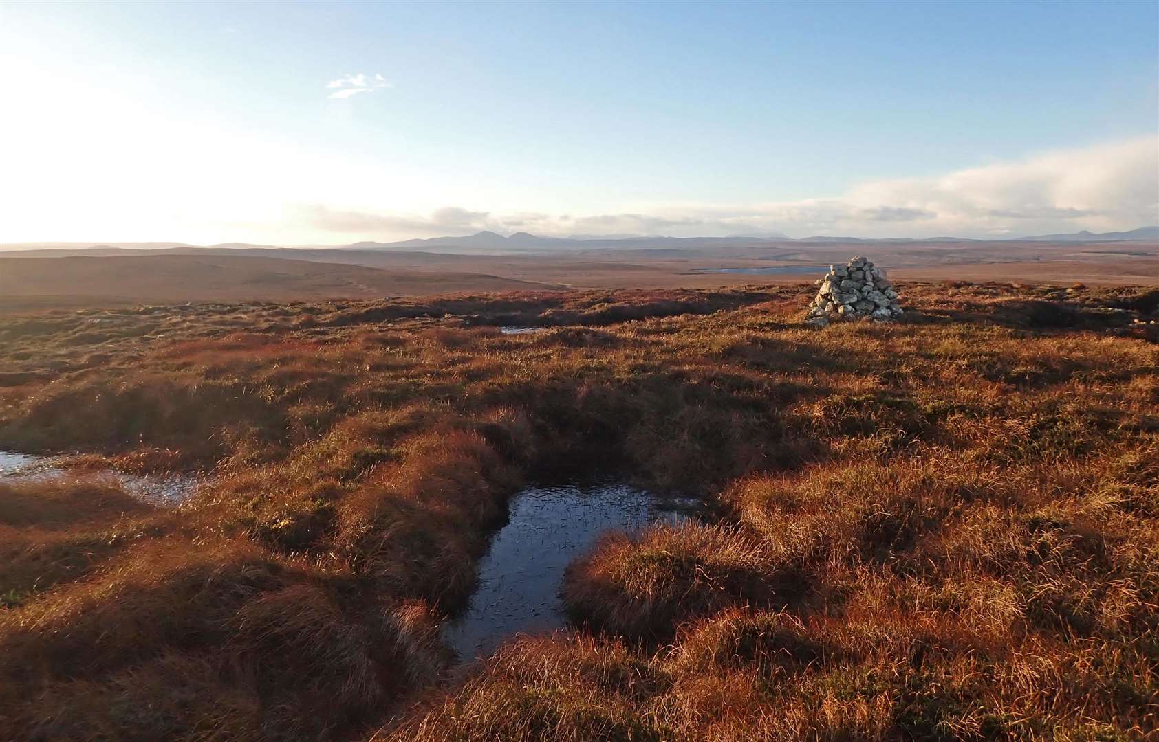
The little rocky summit still rises above all this, with magnificent vistas south and west across the lochans and moors of the Flow Country to the higher peaks of Sutherland. On the clearest of days you can just make out Sule Skerry and Sule Stack far out at sea to the north. More proposed wind farms at Drumholiston and Akran mean that the hill will be almost completely ringed by turbines in the near future.
The hill-running route carries on west to little Loch Garbh then picks up an old stalkers’ path heading back to the main road. I prefer to keep on the ridge north to the lower tops which overlook Reay then make a rough and pathless route down steep slopes and across boggy ground to the Helshetter track.
Even in my unfit state I managed the round walk easily in a morning – once upon a time I could run it in 90 minutes.
The source of the Sandside Burn lies six miles south of Reay in two deep lochans in steep-sided basins, unusual for Caithness and most surprising if you come across them unawares. I’ve always known them as the 'Binocular Lochs’.
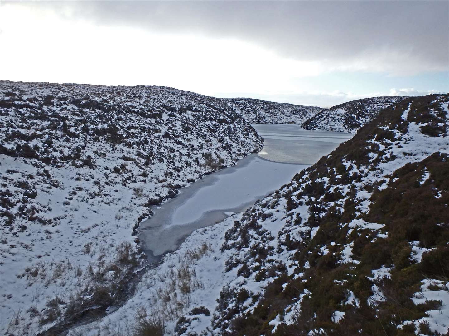
The narrow Glen Chorcaill then leads northwards for a mile or two before opening out into the wider valley. On a day of frozen ground, carrying on a long way south from Beinn Ratha to locate the two tiny lochans then descending Gleann Chorcaill takes you as far from habitation as it’s possible to get in the county, and gives as good a day out as any hill walk in the Highlands.
But do it now before the landscape is totally transformed by the huge wind farms!